You are here: Home > Network List > TA - USArray Transportable Network (new EarthScope stations) Stations List
> Station J20K Nowitna River, AK, USA > Earthquake Result Viewer
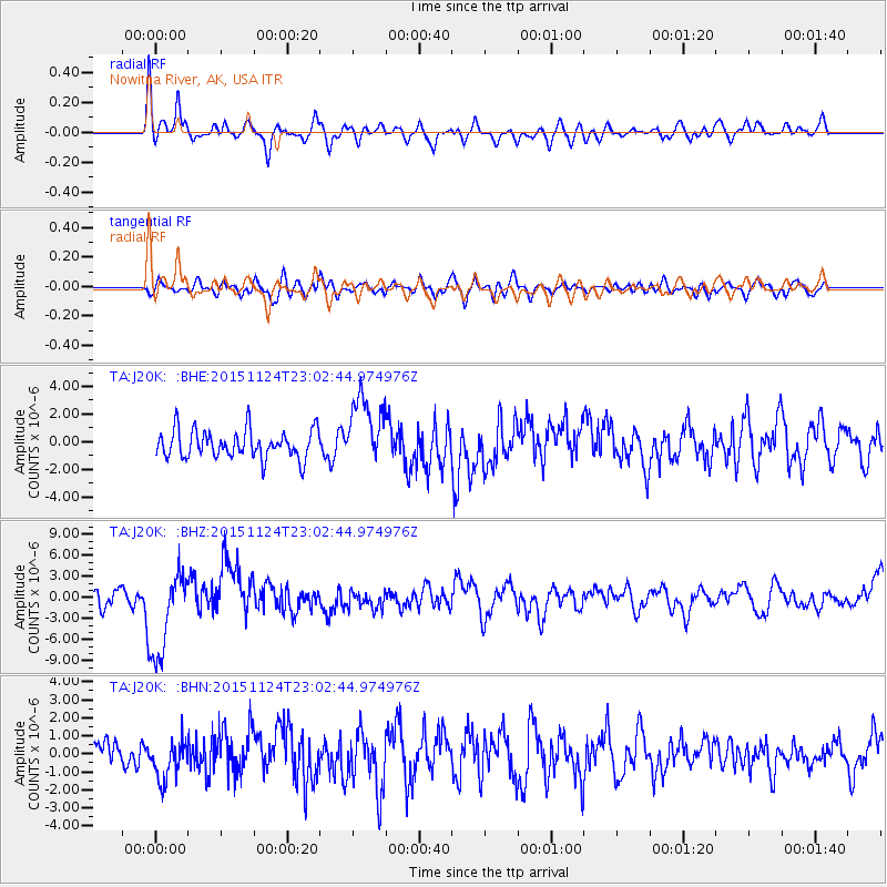
J20K Nowitna River, AK, USA - Earthquake Result Viewer
*The percent match for this event was below the threshold and hence no stack was calculated.
| Earthquake location: |
Peru-Brazil Border Region |
| Earthquake latitude/longitude: |
-10.1/-71.1 |
| Earthquake time(UTC): |
2015/11/24 (328) 22:50:53 GMT |
| Earthquake Depth: |
595 km |
| Earthquake Magnitude: |
5.9 MB |
| Earthquake Catalog/Contributor: |
NEIC PDE/NEIC COMCAT |
|
| Network: |
TA USArray Transportable Network (new EarthScope stations) |
| Station: |
J20K Nowitna River, AK, USA |
| Lat/Lon: |
64.18 N/154.15 W |
| Elevation: |
314 m |
|
| Distance: |
96.0 deg |
| Az: |
334.076 deg |
| Baz: |
100.61 deg |
| Ray Param: |
$rayparam |
*The percent match for this event was below the threshold and hence was not used in the summary stack. |
|
| Radial Match: |
75.827034 % |
| Radial Bump: |
400 |
| Transverse Match: |
49.223446 % |
| Transverse Bump: |
400 |
| SOD ConfigId: |
7422571 |
| Insert Time: |
2019-04-21 11:50:39.837 +0000 |
| GWidth: |
2.5 |
| Max Bumps: |
400 |
| Tol: |
0.001 |
|
Signal To Noise
| Channel | StoN | STA | LTA |
| TA:J20K: :BHZ:20151124T23:02:44.974976Z | 5.515351 | 6.1563637E-6 | 1.1162234E-6 |
| TA:J20K: :BHN:20151124T23:02:44.974976Z | 1.3159747 | 1.1213432E-6 | 8.5210087E-7 |
| TA:J20K: :BHE:20151124T23:02:44.974976Z | 2.5163133 | 2.5785525E-6 | 1.0247343E-6 |
| Arrivals |
| Ps | |
| PpPs | |
| PsPs/PpSs | |


