KMI Kunming, Yunnan Province, China - Earthquake Result Viewer
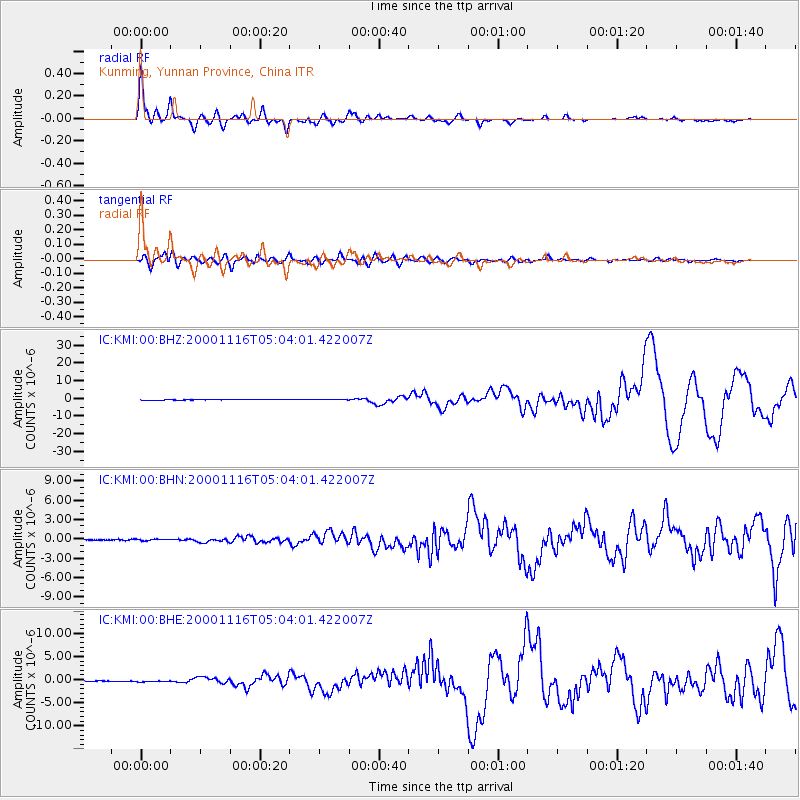
Earthquake location: New Ireland Region, P.N.G.
Earthquake latitude/longitude: -4.0/152.2
Earthquake time(UTC): 2000/11/16 (321) 04:54:56 GMT
Earthquake Depth: 33 km
Earthquake Magnitude: 6.0 MB, 8.2 MS, 8.0 MW, 8.0 ME
Earthquake Catalog/Contributor: WHDF/NEIC
Network: IC New China Digital Seismograph Network
Station: KMI Kunming, Yunnan Province, China
Lat/Lon: 25.12 N/102.74 E
Elevation: 1975 m
Distance: 56.0 deg
Az: 303.853 deg
Baz: 113.941 deg
Ray Param: 0.06436197
Estimated Moho Depth: 40.75 km
Estimated Crust Vp/Vs: 1.72
Assumed Crust Vp: 6.247 km/s
Estimated Crust Vs: 3.642 km/s
Estimated Crust Poisson's Ratio: 0.24
Radial Match: 93.79812 %
Radial Bump: 400
Transverse Match: 77.21583 %
Transverse Bump: 400
SOD ConfigId: 3744
Insert Time: 2010-03-04 22:20:10.612 +0000
GWidth: 2.5
Max Bumps: 400
Tol: 0.001

Signal To Noise

ChannelStoNSTALTA
IC:KMI:00:BHN:20001116T05:04:01.422007Z1.56277551.1419479E-77.307178E-8
IC:KMI:00:BHE:20001116T05:04:01.422007Z2.07055741.4791581E-77.143768E-8
IC:KMI:00:BHZ:20001116T05:04:01.422007Z2.47584033.2704668E-71.3209522E-7
Arrivals
Ps4.9 SECOND
PpPs17 SECOND
PsPs/PpSs22 SECOND