KMI Kunming, Yunnan Province, China - Earthquake Result Viewer
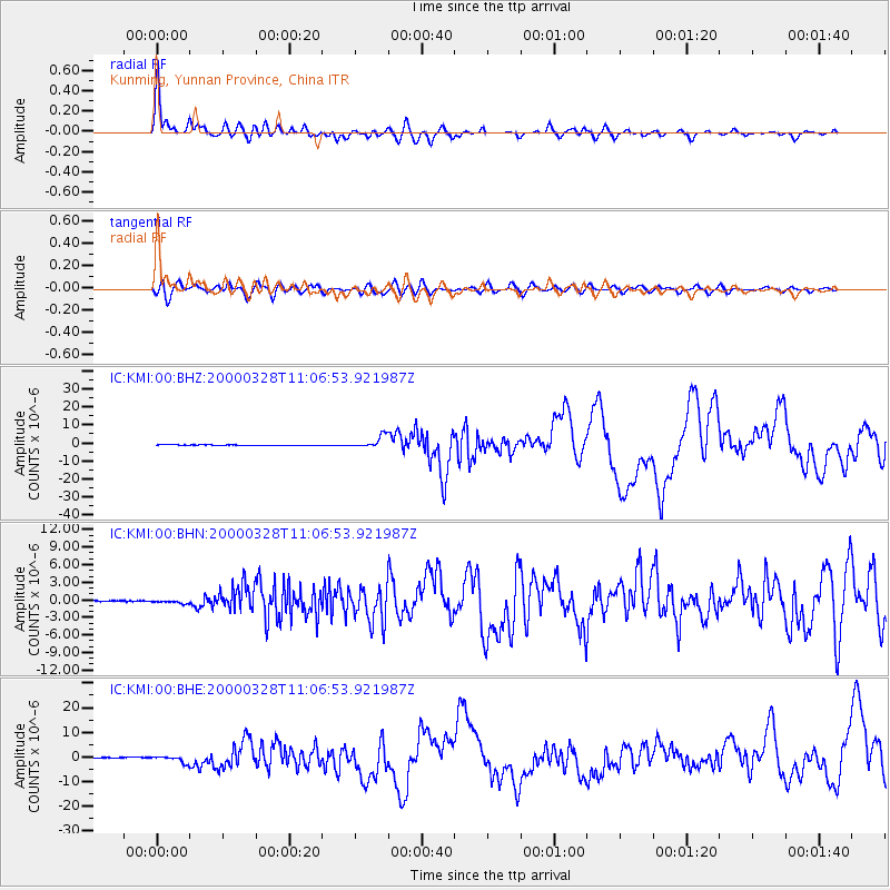
Earthquake location: Volcano Islands, Japan Region
Earthquake latitude/longitude: 22.3/143.7
Earthquake time(UTC): 2000/03/28 (088) 11:00:22 GMT
Earthquake Depth: 126 km
Earthquake Magnitude: 6.8 MB, 7.6 MS, 7.6 MW, 7.6 MW
Earthquake Catalog/Contributor: WHDF/NEIC
Network: IC New China Digital Seismograph Network
Station: KMI Kunming, Yunnan Province, China
Lat/Lon: 25.12 N/102.74 E
Elevation: 1975 m
Distance: 37.5 deg
Az: 282.55 deg
Baz: 85.53 deg
Ray Param: 0.07564089
Estimated Moho Depth: 26.75 km
Estimated Crust Vp/Vs: 2.10
Assumed Crust Vp: 6.247 km/s
Estimated Crust Vs: 2.978 km/s
Estimated Crust Poisson's Ratio: 0.35
Radial Match: 94.77445 %
Radial Bump: 400
Transverse Match: 84.360016 %
Transverse Bump: 400
SOD ConfigId: 3744
Insert Time: 2010-03-04 22:21:28.448 +0000
GWidth: 2.5
Max Bumps: 400
Tol: 0.001

Signal To Noise

ChannelStoNSTALTA
IC:KMI:00:BHN:20000328T11:06:53.921987Z4.17860563.190743E-77.635904E-8
IC:KMI:00:BHE:20000328T11:06:53.921987Z6.7120261.3033091E-61.9417521E-7
IC:KMI:00:BHZ:20000328T11:06:53.921987Z21.0284123.357824E-61.5968034E-7
Arrivals
Ps5.0 SECOND
PpPs13 SECOND
PsPs/PpSs18 SECOND