You are here: Home > Network List > AZ - ANZA Regional Network Stations List
> Station SMER AZ.SMER > Earthquake Result Viewer
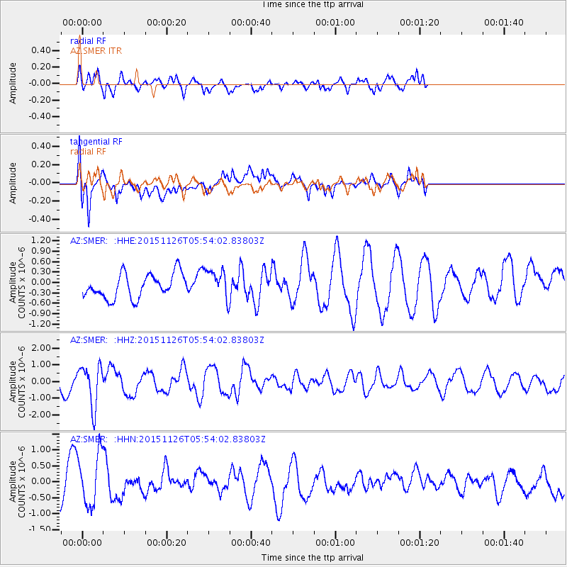
SMER AZ.SMER - Earthquake Result Viewer
*The percent match for this event was below the threshold and hence no stack was calculated.
| Earthquake location: |
Peru-Brazil Border Region |
| Earthquake latitude/longitude: |
-9.2/-71.3 |
| Earthquake time(UTC): |
2015/11/26 (330) 05:45:18 GMT |
| Earthquake Depth: |
604 km |
| Earthquake Magnitude: |
6.4 MWP |
| Earthquake Catalog/Contributor: |
NEIC PDE/NEIC COMCAT |
|
| Network: |
AZ ANZA Regional Network |
| Station: |
SMER AZ.SMER |
| Lat/Lon: |
33.46 N/117.17 W |
| Elevation: |
355 m |
|
| Distance: |
60.9 deg |
| Az: |
316.581 deg |
| Baz: |
125.741 deg |
| Ray Param: |
$rayparam |
*The percent match for this event was below the threshold and hence was not used in the summary stack. |
|
| Radial Match: |
70.19695 % |
| Radial Bump: |
354 |
| Transverse Match: |
77.85484 % |
| Transverse Bump: |
400 |
| SOD ConfigId: |
7422571 |
| Insert Time: |
2019-04-21 12:01:17.465 +0000 |
| GWidth: |
2.5 |
| Max Bumps: |
400 |
| Tol: |
0.001 |
|
Signal To Noise
| Channel | StoN | STA | LTA |
| AZ:SMER: :HHZ:20151126T05:54:02.83803Z | 2.3665347 | 1.2464288E-6 | 5.2668946E-7 |
| AZ:SMER: :HHN:20151126T05:54:02.83803Z | 1.593911 | 8.2022655E-7 | 5.1459995E-7 |
| AZ:SMER: :HHE:20151126T05:54:02.83803Z | 1.2091037 | 4.183928E-7 | 3.460355E-7 |
| Arrivals |
| Ps | |
| PpPs | |
| PsPs/PpSs | |


