
KMI Kunming, Yunnan Province, China - Earthquake Result Viewer
| ||||||||||||||||||
| ||||||||||||||||||
| ||||||||||||||||||
|
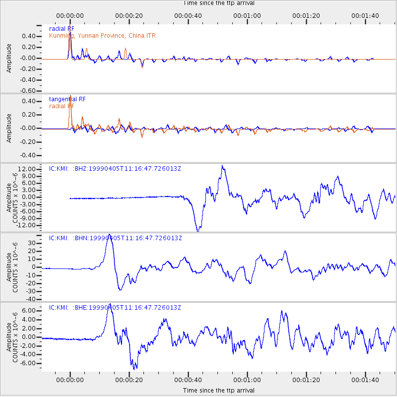
Signal To Noise
| Channel | StoN | STA | LTA |
| IC:KMI: :BHN:19990405T11:16:47.726013Z | 3.3738027 | 1.0522108E-6 | 3.1187682E-7 |
| IC:KMI: :BHE:19990405T11:16:47.726013Z | 3.612946 | 3.3590499E-7 | 9.29726E-8 |
| IC:KMI: :BHZ:19990405T11:16:47.726013Z | 4.2657943 | 6.288383E-7 | 1.4741413E-7 |
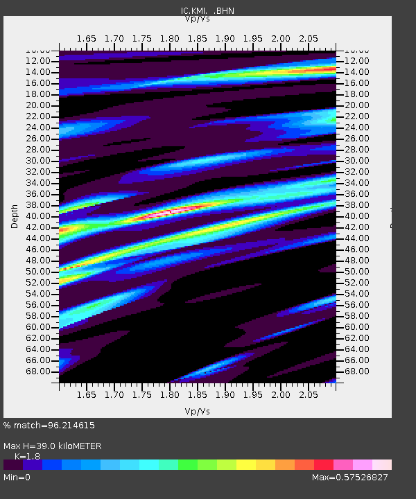
| Arrivals | |
| Ps | 5.2 SECOND |
| PpPs | 17 SECOND |
| PsPs/PpSs | 22 SECOND |

