
KMI Kunming, Yunnan Province, China - Earthquake Result Viewer
| ||||||||||||||||||
| ||||||||||||||||||
| ||||||||||||||||||
|
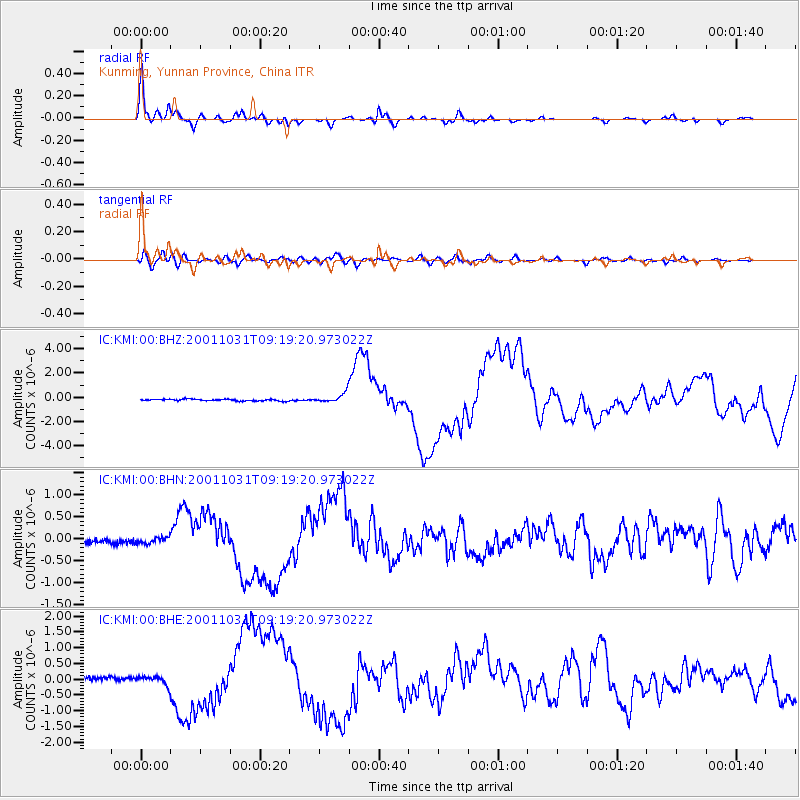
Signal To Noise
| Channel | StoN | STA | LTA |
| IC:KMI:00:BHN:20011031T09:19:20.973022Z | 1.3985881 | 6.928773E-8 | 4.95412E-8 |
| IC:KMI:00:BHE:20011031T09:19:20.973022Z | 2.6072323 | 1.3184783E-7 | 5.0570033E-8 |
| IC:KMI:00:BHZ:20011031T09:19:20.973022Z | 5.6604805 | 3.8611196E-7 | 6.821187E-8 |
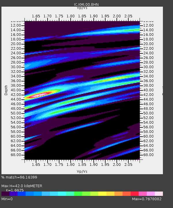
| Arrivals | |
| Ps | 4.7 SECOND |
| PpPs | 17 SECOND |
| PsPs/PpSs | 22 SECOND |

