You are here: Home > Network List > CI - Caltech Regional Seismic Network Stations List
> Station GLA Glamis, Glamis, CA, USA > Earthquake Result Viewer
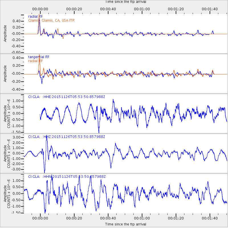
GLA Glamis, Glamis, CA, USA - Earthquake Result Viewer
*The percent match for this event was below the threshold and hence no stack was calculated.
| Earthquake location: |
Peru-Brazil Border Region |
| Earthquake latitude/longitude: |
-9.2/-71.3 |
| Earthquake time(UTC): |
2015/11/26 (330) 05:45:18 GMT |
| Earthquake Depth: |
604 km |
| Earthquake Magnitude: |
6.4 MWP |
| Earthquake Catalog/Contributor: |
NEIC PDE/NEIC COMCAT |
|
| Network: |
CI Caltech Regional Seismic Network |
| Station: |
GLA Glamis, Glamis, CA, USA |
| Lat/Lon: |
33.05 N/114.83 W |
| Elevation: |
610 m |
|
| Distance: |
59.0 deg |
| Az: |
317.559 deg |
| Baz: |
127.51 deg |
| Ray Param: |
$rayparam |
*The percent match for this event was below the threshold and hence was not used in the summary stack. |
|
| Radial Match: |
74.7348 % |
| Radial Bump: |
336 |
| Transverse Match: |
40.315056 % |
| Transverse Bump: |
257 |
| SOD ConfigId: |
7422571 |
| Insert Time: |
2019-04-21 12:02:13.983 +0000 |
| GWidth: |
2.5 |
| Max Bumps: |
400 |
| Tol: |
0.001 |
|
Signal To Noise
| Channel | StoN | STA | LTA |
| CI:GLA: :HHZ:20151126T05:53:50.857988Z | 3.6911578 | 1.6521376E-6 | 4.4759332E-7 |
| CI:GLA: :HHN:20151126T05:53:50.857988Z | 2.9643896 | 6.2539766E-7 | 2.1097014E-7 |
| CI:GLA: :HHE:20151126T05:53:50.857988Z | 1.4620653 | 6.375122E-7 | 4.3603535E-7 |
| Arrivals |
| Ps | |
| PpPs | |
| PsPs/PpSs | |


