You are here: Home > Network List > CI - Caltech Regional Seismic Network Stations List
> Station MPP McPhearson Peak > Earthquake Result Viewer
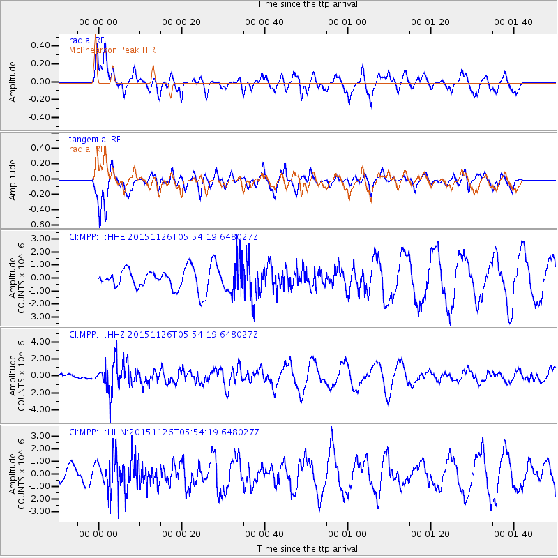
MPP McPhearson Peak - Earthquake Result Viewer
*The percent match for this event was below the threshold and hence no stack was calculated.
| Earthquake location: |
Peru-Brazil Border Region |
| Earthquake latitude/longitude: |
-9.2/-71.3 |
| Earthquake time(UTC): |
2015/11/26 (330) 05:45:18 GMT |
| Earthquake Depth: |
604 km |
| Earthquake Magnitude: |
6.4 MWP |
| Earthquake Catalog/Contributor: |
NEIC PDE/NEIC COMCAT |
|
| Network: |
CI Caltech Regional Seismic Network |
| Station: |
MPP McPhearson Peak |
| Lat/Lon: |
34.89 N/119.81 W |
| Elevation: |
1739 m |
|
| Distance: |
63.5 deg |
| Az: |
316.483 deg |
| Baz: |
124.217 deg |
| Ray Param: |
$rayparam |
*The percent match for this event was below the threshold and hence was not used in the summary stack. |
|
| Radial Match: |
60.589996 % |
| Radial Bump: |
375 |
| Transverse Match: |
78.44667 % |
| Transverse Bump: |
398 |
| SOD ConfigId: |
7422571 |
| Insert Time: |
2019-04-21 12:02:24.646 +0000 |
| GWidth: |
2.5 |
| Max Bumps: |
400 |
| Tol: |
0.001 |
|
Signal To Noise
| Channel | StoN | STA | LTA |
| CI:MPP: :HHZ:20151126T05:54:19.648027Z | 5.092466 | 1.8119293E-6 | 3.558059E-7 |
| CI:MPP: :HHN:20151126T05:54:19.648027Z | 2.8753126 | 1.3189658E-6 | 4.5872085E-7 |
| CI:MPP: :HHE:20151126T05:54:19.648027Z | 1.5521237 | 1.1746015E-6 | 7.5677053E-7 |
| Arrivals |
| Ps | |
| PpPs | |
| PsPs/PpSs | |


