You are here: Home > Network List > CI - Caltech Regional Seismic Network Stations List
> Station SWS Sam W. Stewart, Westmorland, CA, USA > Earthquake Result Viewer
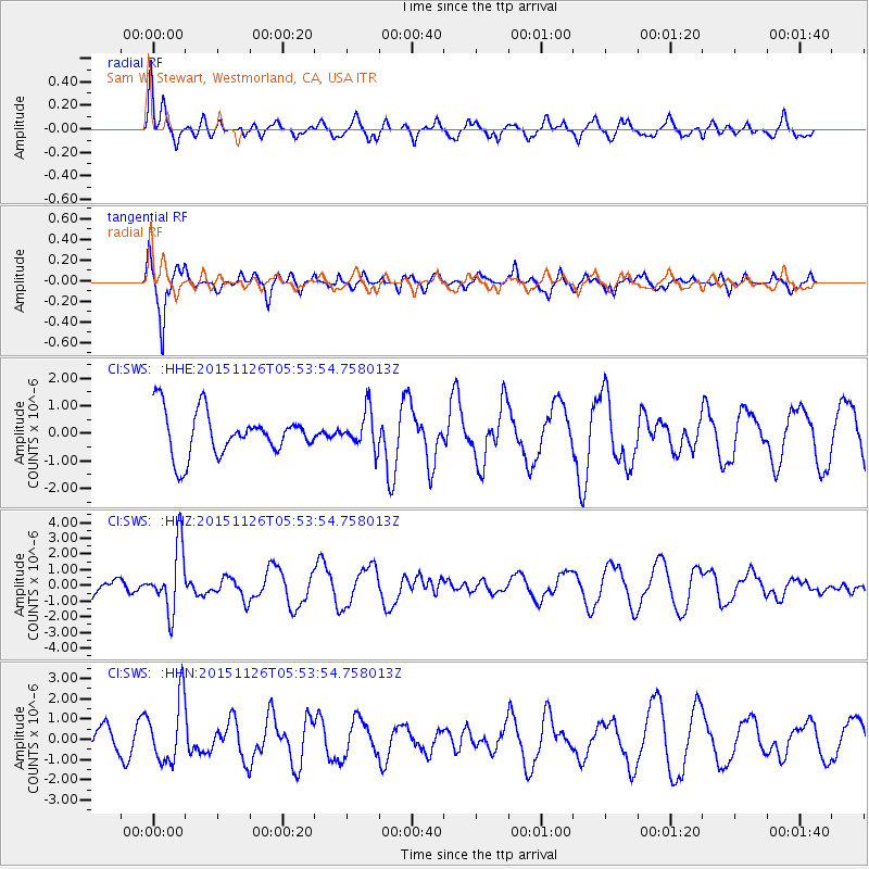
SWS Sam W. Stewart, Westmorland, CA, USA - Earthquake Result Viewer
*The percent match for this event was below the threshold and hence no stack was calculated.
| Earthquake location: |
Peru-Brazil Border Region |
| Earthquake latitude/longitude: |
-9.2/-71.3 |
| Earthquake time(UTC): |
2015/11/26 (330) 05:45:18 GMT |
| Earthquake Depth: |
604 km |
| Earthquake Magnitude: |
6.4 MWP |
| Earthquake Catalog/Contributor: |
NEIC PDE/NEIC COMCAT |
|
| Network: |
CI Caltech Regional Seismic Network |
| Station: |
SWS Sam W. Stewart, Westmorland, CA, USA |
| Lat/Lon: |
32.94 N/115.80 W |
| Elevation: |
140 m |
|
| Distance: |
59.6 deg |
| Az: |
316.886 deg |
| Baz: |
126.641 deg |
| Ray Param: |
$rayparam |
*The percent match for this event was below the threshold and hence was not used in the summary stack. |
|
| Radial Match: |
67.52169 % |
| Radial Bump: |
400 |
| Transverse Match: |
76.50512 % |
| Transverse Bump: |
310 |
| SOD ConfigId: |
7422571 |
| Insert Time: |
2019-04-21 12:02:38.335 +0000 |
| GWidth: |
2.5 |
| Max Bumps: |
400 |
| Tol: |
0.001 |
|
Signal To Noise
| Channel | StoN | STA | LTA |
| CI:SWS: :HHZ:20151126T05:53:54.758013Z | 2.9579797 | 2.02858E-6 | 6.857992E-7 |
| CI:SWS: :HHN:20151126T05:53:54.758013Z | 1.7281346 | 1.5406259E-6 | 8.914965E-7 |
| CI:SWS: :HHE:20151126T05:53:54.758013Z | 0.8938019 | 6.782957E-7 | 7.588882E-7 |
| Arrivals |
| Ps | |
| PpPs | |
| PsPs/PpSs | |


