KMI Kunming, Yunnan Province, China - Earthquake Result Viewer
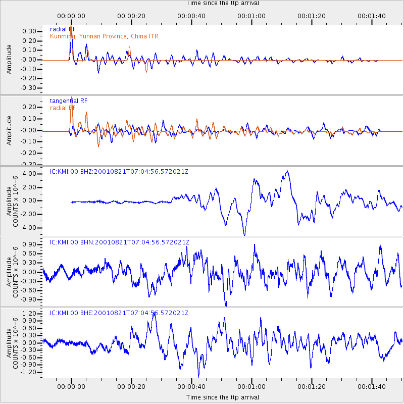
Earthquake location: East Of North Island, N.Z.
Earthquake latitude/longitude: -36.8/-179.6
Earthquake time(UTC): 2001/08/21 (233) 06:52:06 GMT
Earthquake Depth: 33 km
Earthquake Magnitude: 6.4 MB, 7.1 MS, 7.2 ME, 7.0 ML
Earthquake Catalog/Contributor: WHDF/NEIC
Network: IC New China Digital Seismograph Network
Station: KMI Kunming, Yunnan Province, China
Lat/Lon: 25.12 N/102.74 E
Elevation: 1975 m
Distance: 95.6 deg
Az: 297.151 deg
Baz: 128.024 deg
Ray Param: 0.04073754
Estimated Moho Depth: 53.25 km
Estimated Crust Vp/Vs: 1.60
Assumed Crust Vp: 6.247 km/s
Estimated Crust Vs: 3.904 km/s
Estimated Crust Poisson's Ratio: 0.18
Radial Match: 93.951355 %
Radial Bump: 400
Transverse Match: 83.04457 %
Transverse Bump: 400
SOD ConfigId: 20082
Insert Time: 2010-03-04 22:22:44.796 +0000
GWidth: 2.5
Max Bumps: 400
Tol: 0.001

Signal To Noise

ChannelStoNSTALTA
IC:KMI:00:BHN:20010821T07:04:56.572021Z0.95741641.2124839E-71.2664123E-7
IC:KMI:00:BHE:20010821T07:04:56.572021Z0.429932774.993448E-81.1614486E-7
IC:KMI:00:BHZ:20010821T07:04:56.572021Z3.53558253.0251854E-78.556398E-8
Arrivals
Ps5.2 SECOND
PpPs22 SECOND
PsPs/PpSs27 SECOND