KMI Kunming, Yunnan Province, China - Earthquake Result Viewer
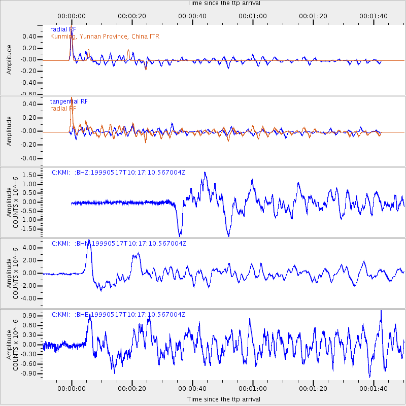
Earthquake location: New Britain Region, P.N.G.
Earthquake latitude/longitude: -5.2/152.9
Earthquake time(UTC): 1999/05/17 (137) 10:07:56 GMT
Earthquake Depth: 27 km
Earthquake Magnitude: 5.5 MB, 6.9 MS, 6.7 MW, 6.0 ME
Earthquake Catalog/Contributor: WHDF/NEIC
Network: IC New China Digital Seismograph Network
Station: KMI Kunming, Yunnan Province, China
Lat/Lon: 25.12 N/102.74 E
Elevation: 1975 m
Distance: 57.3 deg
Az: 304.179 deg
Baz: 114.637 deg
Ray Param: 0.06356735
Estimated Moho Depth: 49.5 km
Estimated Crust Vp/Vs: 1.60
Assumed Crust Vp: 6.247 km/s
Estimated Crust Vs: 3.904 km/s
Estimated Crust Poisson's Ratio: 0.18
Radial Match: 92.20301 %
Radial Bump: 400
Transverse Match: 79.51999 %
Transverse Bump: 400
SOD ConfigId: 4480
Insert Time: 2010-03-04 22:24:04.730 +0000
GWidth: 2.5
Max Bumps: 400
Tol: 0.001

Signal To Noise

ChannelStoNSTALTA
IC:KMI: :BHN:19990517T10:17:10.567004Z11.6192145.7720183E-74.9676498E-8
IC:KMI: :BHE:19990517T10:17:10.567004Z0.95425016.4363945E-86.744977E-8
IC:KMI: :BHZ:19990517T10:17:10.567004Z3.92586951.6852326E-74.2926352E-8
Arrivals
Ps5.0 SECOND
PpPs20 SECOND
PsPs/PpSs25 SECOND