You are here: Home > Network List > TA - USArray Transportable Network (new EarthScope stations) Stations List
> Station L20K Farewell, AK, USA > Earthquake Result Viewer
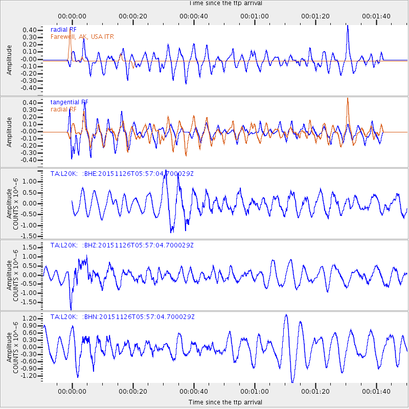
L20K Farewell, AK, USA - Earthquake Result Viewer
*The percent match for this event was below the threshold and hence no stack was calculated.
| Earthquake location: |
Peru-Brazil Border Region |
| Earthquake latitude/longitude: |
-9.2/-71.3 |
| Earthquake time(UTC): |
2015/11/26 (330) 05:45:18 GMT |
| Earthquake Depth: |
604 km |
| Earthquake Magnitude: |
6.4 MWP |
| Earthquake Catalog/Contributor: |
NEIC PDE/NEIC COMCAT |
|
| Network: |
TA USArray Transportable Network (new EarthScope stations) |
| Station: |
L20K Farewell, AK, USA |
| Lat/Lon: |
62.48 N/153.88 W |
| Elevation: |
673 m |
|
| Distance: |
94.7 deg |
| Az: |
332.469 deg |
| Baz: |
100.784 deg |
| Ray Param: |
$rayparam |
*The percent match for this event was below the threshold and hence was not used in the summary stack. |
|
| Radial Match: |
50.422848 % |
| Radial Bump: |
400 |
| Transverse Match: |
55.324944 % |
| Transverse Bump: |
394 |
| SOD ConfigId: |
7422571 |
| Insert Time: |
2019-04-21 12:10:37.849 +0000 |
| GWidth: |
2.5 |
| Max Bumps: |
400 |
| Tol: |
0.001 |
|
Signal To Noise
| Channel | StoN | STA | LTA |
| TA:L20K: :BHZ:20151126T05:57:04.700029Z | 2.5906525 | 8.2125035E-7 | 3.170052E-7 |
| TA:L20K: :BHN:20151126T05:57:04.700029Z | 1.1739398 | 6.386819E-7 | 5.4404995E-7 |
| TA:L20K: :BHE:20151126T05:57:04.700029Z | 2.5825064 | 9.588009E-7 | 3.712676E-7 |
| Arrivals |
| Ps | |
| PpPs | |
| PsPs/PpSs | |


