KMI Kunming, Yunnan Province, China - Earthquake Result Viewer
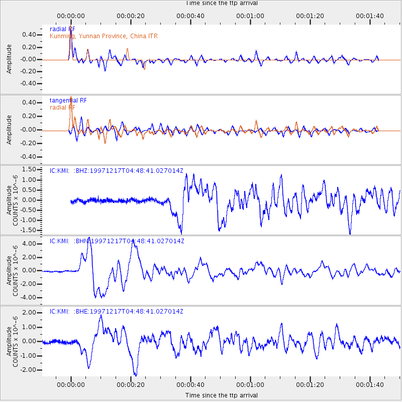
Earthquake location: Rat Islands, Aleutian Islands
Earthquake latitude/longitude: 51.2/178.9
Earthquake time(UTC): 1997/12/17 (351) 04:38:51 GMT
Earthquake Depth: 20 km
Earthquake Magnitude: 5.8 MB, 6.5 MS, 6.7 UNKNOWN, 6.1 ME
Earthquake Catalog/Contributor: WHDF/NEIC
Network: IC New China Digital Seismograph Network
Station: KMI Kunming, Yunnan Province, China
Lat/Lon: 25.12 N/102.74 E
Elevation: 1975 m
Distance: 62.3 deg
Az: 276.281 deg
Baz: 43.637 deg
Ray Param: 0.060296807
Estimated Moho Depth: 14.0 km
Estimated Crust Vp/Vs: 1.60
Assumed Crust Vp: 6.247 km/s
Estimated Crust Vs: 3.904 km/s
Estimated Crust Poisson's Ratio: 0.18
Radial Match: 96.024216 %
Radial Bump: 364
Transverse Match: 88.26747 %
Transverse Bump: 400
SOD ConfigId: 4480
Insert Time: 2010-03-04 22:25:22.614 +0000
GWidth: 2.5
Max Bumps: 400
Tol: 0.001

Signal To Noise

ChannelStoNSTALTA
IC:KMI: :BHN:19971217T04:48:41.027014Z18.2691151.1729896E-66.4206155E-8
IC:KMI: :BHE:19971217T04:48:41.027014Z4.14583873.5229115E-78.497463E-8
IC:KMI: :BHZ:19971217T04:48:41.027014Z4.9699063.2875926E-76.6149994E-8
Arrivals
Ps1.4 SECOND
PpPs5.6 SECOND
PsPs/PpSs7.0 SECOND