You are here: Home > Network List > TA - USArray Transportable Network (new EarthScope stations) Stations List
> Station O03E Paynes Creek, CA, USA > Earthquake Result Viewer
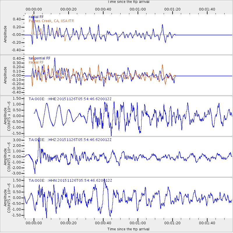
O03E Paynes Creek, CA, USA - Earthquake Result Viewer
*The percent match for this event was below the threshold and hence no stack was calculated.
| Earthquake location: |
Peru-Brazil Border Region |
| Earthquake latitude/longitude: |
-9.2/-71.3 |
| Earthquake time(UTC): |
2015/11/26 (330) 05:45:18 GMT |
| Earthquake Depth: |
604 km |
| Earthquake Magnitude: |
6.4 MWP |
| Earthquake Catalog/Contributor: |
NEIC PDE/NEIC COMCAT |
|
| Network: |
TA USArray Transportable Network (new EarthScope stations) |
| Station: |
O03E Paynes Creek, CA, USA |
| Lat/Lon: |
40.29 N/121.80 W |
| Elevation: |
967 m |
|
| Distance: |
67.8 deg |
| Az: |
320.387 deg |
| Baz: |
124.619 deg |
| Ray Param: |
$rayparam |
*The percent match for this event was below the threshold and hence was not used in the summary stack. |
|
| Radial Match: |
68.27 % |
| Radial Bump: |
400 |
| Transverse Match: |
47.90422 % |
| Transverse Bump: |
346 |
| SOD ConfigId: |
7422571 |
| Insert Time: |
2019-04-21 12:10:56.485 +0000 |
| GWidth: |
2.5 |
| Max Bumps: |
400 |
| Tol: |
0.001 |
|
Signal To Noise
| Channel | StoN | STA | LTA |
| TA:O03E: :HHZ:20151126T05:54:46.620012Z | 3.6880476 | 1.6040618E-6 | 4.349352E-7 |
| TA:O03E: :HHN:20151126T05:54:46.620012Z | 2.4251702 | 6.1226336E-7 | 2.52462E-7 |
| TA:O03E: :HHE:20151126T05:54:46.620012Z | 0.97644264 | 5.4206055E-7 | 5.551382E-7 |
| Arrivals |
| Ps | |
| PpPs | |
| PsPs/PpSs | |


