KMI Kunming, Yunnan Province, China - Earthquake Result Viewer
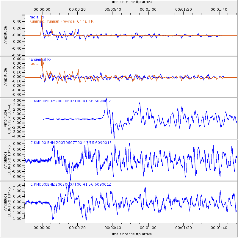
Earthquake location: New Britain Region, P.N.G.
Earthquake latitude/longitude: -5.1/152.5
Earthquake time(UTC): 2003/06/07 (158) 00:32:45 GMT
Earthquake Depth: 33 km
Earthquake Magnitude: 6.0 MB, 6.8 MS, 6.6 MW, 6.5 MW
Earthquake Catalog/Contributor: WHDF/NEIC
Network: IC New China Digital Seismograph Network
Station: KMI Kunming, Yunnan Province, China
Lat/Lon: 25.12 N/102.74 E
Elevation: 1975 m
Distance: 56.9 deg
Az: 304.312 deg
Baz: 114.819 deg
Ray Param: 0.063776754
Estimated Moho Depth: 42.75 km
Estimated Crust Vp/Vs: 1.63
Assumed Crust Vp: 6.247 km/s
Estimated Crust Vs: 3.82 km/s
Estimated Crust Poisson's Ratio: 0.20
Radial Match: 92.666855 %
Radial Bump: 400
Transverse Match: 83.442535 %
Transverse Bump: 400
SOD ConfigId: 4714
Insert Time: 2010-03-04 22:25:26.142 +0000
GWidth: 2.5
Max Bumps: 400
Tol: 0.001

Signal To Noise

ChannelStoNSTALTA
IC:KMI:00:BHN:20030607T00:41:56.609001Z0.709543355.163977E-87.277888E-8
IC:KMI:00:BHE:20030607T00:41:56.609001Z1.88661631.0792041E-75.7203152E-8
IC:KMI:00:BHZ:20030607T00:41:56.609001Z4.52758552.457884E-75.428686E-8
Arrivals
Ps4.6 SECOND
PpPs17 SECOND
PsPs/PpSs22 SECOND