You are here: Home > Network List > TA - USArray Transportable Network (new EarthScope stations) Stations List
> Station TPFO Pinon Flats, CA, USA > Earthquake Result Viewer
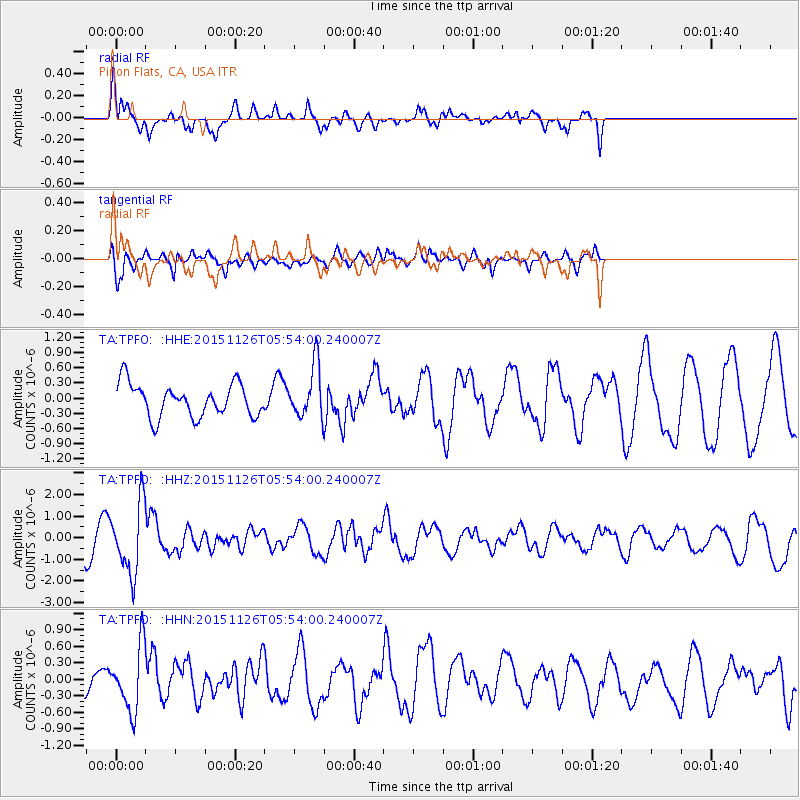
TPFO Pinon Flats, CA, USA - Earthquake Result Viewer
*The percent match for this event was below the threshold and hence no stack was calculated.
| Earthquake location: |
Peru-Brazil Border Region |
| Earthquake latitude/longitude: |
-9.2/-71.3 |
| Earthquake time(UTC): |
2015/11/26 (330) 05:45:18 GMT |
| Earthquake Depth: |
604 km |
| Earthquake Magnitude: |
6.4 MWP |
| Earthquake Catalog/Contributor: |
NEIC PDE/NEIC COMCAT |
|
| Network: |
TA USArray Transportable Network (new EarthScope stations) |
| Station: |
TPFO Pinon Flats, CA, USA |
| Lat/Lon: |
33.61 N/116.45 W |
| Elevation: |
1275 m |
|
| Distance: |
60.5 deg |
| Az: |
317.122 deg |
| Baz: |
126.4 deg |
| Ray Param: |
$rayparam |
*The percent match for this event was below the threshold and hence was not used in the summary stack. |
|
| Radial Match: |
69.7856 % |
| Radial Bump: |
304 |
| Transverse Match: |
75.15632 % |
| Transverse Bump: |
343 |
| SOD ConfigId: |
7422571 |
| Insert Time: |
2019-04-21 12:11:12.105 +0000 |
| GWidth: |
2.5 |
| Max Bumps: |
400 |
| Tol: |
0.001 |
|
Signal To Noise
| Channel | StoN | STA | LTA |
| TA:TPFO: :HHZ:20151126T05:54:00.240007Z | 2.6966567 | 1.6268531E-6 | 6.032852E-7 |
| TA:TPFO: :HHN:20151126T05:54:00.240007Z | 1.5700017 | 5.9256035E-7 | 3.7742655E-7 |
| TA:TPFO: :HHE:20151126T05:54:00.240007Z | 1.7300904 | 5.5599816E-7 | 3.213694E-7 |
| Arrivals |
| Ps | |
| PpPs | |
| PsPs/PpSs | |


