You are here: Home > Network List > UW - Pacific Northwest Regional Seismic Network Stations List
> Station MRBL Marblemount, WA, USA > Earthquake Result Viewer
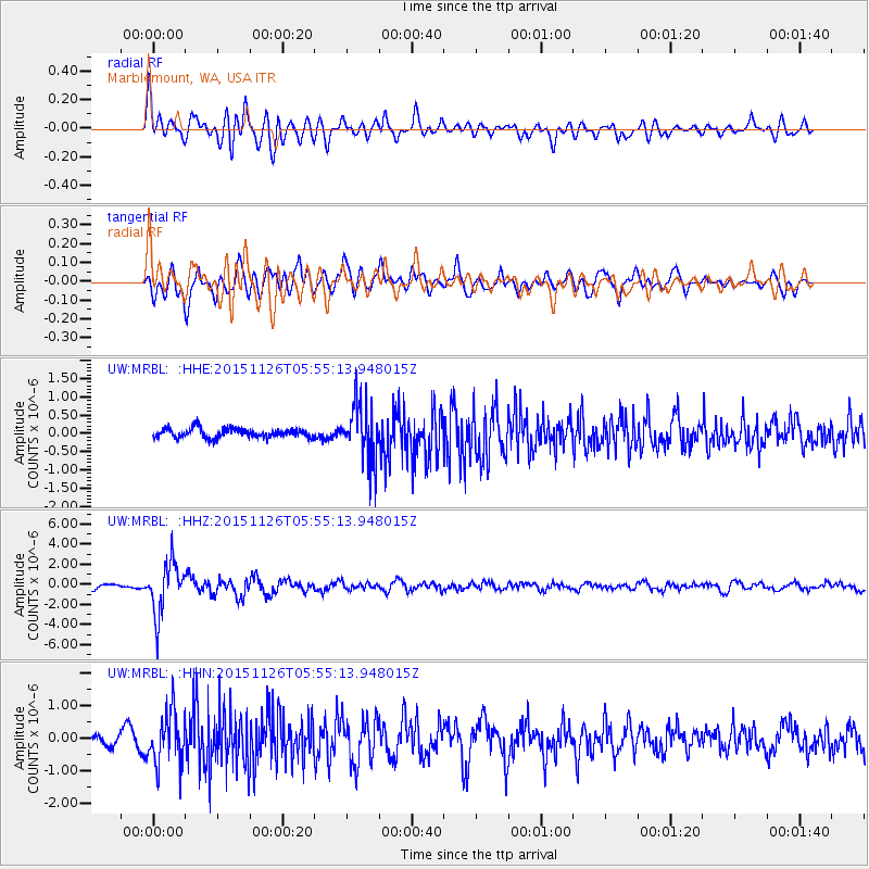
MRBL Marblemount, WA, USA - Earthquake Result Viewer
*The percent match for this event was below the threshold and hence no stack was calculated.
| Earthquake location: |
Peru-Brazil Border Region |
| Earthquake latitude/longitude: |
-9.2/-71.3 |
| Earthquake time(UTC): |
2015/11/26 (330) 05:45:18 GMT |
| Earthquake Depth: |
604 km |
| Earthquake Magnitude: |
6.4 MWP |
| Earthquake Catalog/Contributor: |
NEIC PDE/NEIC COMCAT |
|
| Network: |
UW Pacific Northwest Regional Seismic Network |
| Station: |
MRBL Marblemount, WA, USA |
| Lat/Lon: |
48.52 N/121.48 W |
| Elevation: |
75 m |
|
| Distance: |
72.5 deg |
| Az: |
327.604 deg |
| Baz: |
127.295 deg |
| Ray Param: |
$rayparam |
*The percent match for this event was below the threshold and hence was not used in the summary stack. |
|
| Radial Match: |
78.79986 % |
| Radial Bump: |
400 |
| Transverse Match: |
72.962746 % |
| Transverse Bump: |
400 |
| SOD ConfigId: |
7422571 |
| Insert Time: |
2019-04-21 12:11:59.896 +0000 |
| GWidth: |
2.5 |
| Max Bumps: |
400 |
| Tol: |
0.001 |
|
Signal To Noise
| Channel | StoN | STA | LTA |
| UW:MRBL: :HHZ:20151126T05:55:13.948015Z | 11.020407 | 2.5683933E-6 | 2.3305793E-7 |
| UW:MRBL: :HHN:20151126T05:55:13.948015Z | 3.9473364 | 8.0678177E-7 | 2.0438637E-7 |
| UW:MRBL: :HHE:20151126T05:55:13.948015Z | 6.1637874 | 7.9888406E-7 | 1.2960929E-7 |
| Arrivals |
| Ps | |
| PpPs | |
| PsPs/PpSs | |


