You are here: Home > Network List > UW - Pacific Northwest Regional Seismic Network Stations List
> Station PASS Maple Falls, WA, USA > Earthquake Result Viewer
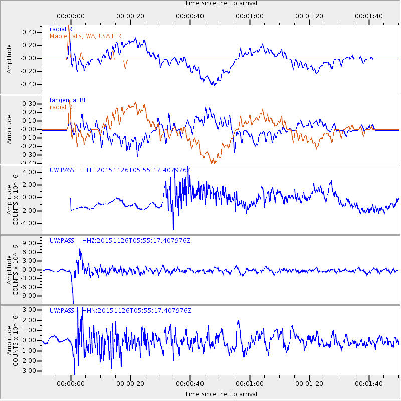
PASS Maple Falls, WA, USA - Earthquake Result Viewer
*The percent match for this event was below the threshold and hence no stack was calculated.
| Earthquake location: |
Peru-Brazil Border Region |
| Earthquake latitude/longitude: |
-9.2/-71.3 |
| Earthquake time(UTC): |
2015/11/26 (330) 05:45:18 GMT |
| Earthquake Depth: |
604 km |
| Earthquake Magnitude: |
6.4 MWP |
| Earthquake Catalog/Contributor: |
NEIC PDE/NEIC COMCAT |
|
| Network: |
UW Pacific Northwest Regional Seismic Network |
| Station: |
PASS Maple Falls, WA, USA |
| Lat/Lon: |
49.00 N/122.09 W |
| Elevation: |
174 m |
|
| Distance: |
73.1 deg |
| Az: |
327.754 deg |
| Baz: |
126.89 deg |
| Ray Param: |
$rayparam |
*The percent match for this event was below the threshold and hence was not used in the summary stack. |
|
| Radial Match: |
44.05987 % |
| Radial Bump: |
400 |
| Transverse Match: |
61.437065 % |
| Transverse Bump: |
400 |
| SOD ConfigId: |
7422571 |
| Insert Time: |
2019-04-21 12:12:03.129 +0000 |
| GWidth: |
2.5 |
| Max Bumps: |
400 |
| Tol: |
0.001 |
|
Signal To Noise
| Channel | StoN | STA | LTA |
| UW:PASS: :HHZ:20151126T05:55:17.407976Z | 15.119304 | 4.147218E-6 | 2.7429954E-7 |
| UW:PASS: :HHN:20151126T05:55:17.407976Z | 6.5161605 | 1.4023484E-6 | 2.1521085E-7 |
| UW:PASS: :HHE:20151126T05:55:17.407976Z | 4.190781 | 2.0366192E-6 | 4.8597605E-7 |
| Arrivals |
| Ps | |
| PpPs | |
| PsPs/PpSs | |


