KMI Kunming, Yunnan Province, China - Earthquake Result Viewer
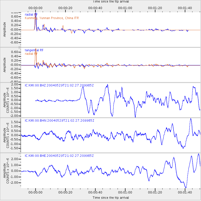
Earthquake location: Off East Coast Of Honshu, Japan
Earthquake latitude/longitude: 34.3/141.4
Earthquake time(UTC): 2004/05/29 (150) 20:56:09 GMT
Earthquake Depth: 16 km
Earthquake Magnitude: 5.6 MB, 6.6 MS, 6.5 MW, 6.3 MW
Earthquake Catalog/Contributor: WHDF/NEIC
Network: IC New China Digital Seismograph Network
Station: KMI Kunming, Yunnan Province, China
Lat/Lon: 25.12 N/102.74 E
Elevation: 1975 m
Distance: 34.6 deg
Az: 265.278 deg
Baz: 65.6 deg
Ray Param: 0.07762797
Estimated Moho Depth: 34.5 km
Estimated Crust Vp/Vs: 1.89
Assumed Crust Vp: 6.247 km/s
Estimated Crust Vs: 3.309 km/s
Estimated Crust Poisson's Ratio: 0.30
Radial Match: 92.850784 %
Radial Bump: 335
Transverse Match: 73.49724 %
Transverse Bump: 400
SOD ConfigId: 2459
Insert Time: 2010-03-04 22:26:02.699 +0000
GWidth: 2.5
Max Bumps: 400
Tol: 0.001

Signal To Noise

ChannelStoNSTALTA
IC:KMI:00:BHN:20040529T21:02:27.209985Z4.3198172.7457153E-76.356092E-8
IC:KMI:00:BHE:20040529T21:02:27.209985Z8.4567144.5405775E-75.3691984E-8
IC:KMI:00:BHZ:20040529T21:02:27.209985Z17.3054079.441631E-75.455885E-8
Arrivals
Ps5.2 SECOND
PpPs15 SECOND
PsPs/PpSs20 SECOND