You are here: Home > Network List > II - Global Seismograph Network (GSN - IRIS/IDA) Stations List
> Station PFO Pinon Flat, California, USA > Earthquake Result Viewer
PFO Pinon Flat, California, USA - Earthquake Result Viewer
*The percent match for this event was below the threshold and hence no stack was calculated.
| Earthquake location: |
Kuril Islands |
| Earthquake latitude/longitude: |
47.9/152.5 |
| Earthquake time(UTC): |
2009/10/10 (283) 21:24:38 GMT |
| Earthquake Depth: |
112 km |
| Earthquake Magnitude: |
5.9 MB, 6.0 MW, 6.0 MW |
| Earthquake Catalog/Contributor: |
WHDF/NEIC |
|
| Network: |
II Global Seismograph Network (GSN - IRIS/IDA) |
| Station: |
PFO Pinon Flat, California, USA |
| Lat/Lon: |
33.61 N/116.46 W |
| Elevation: |
1280 m |
|
| Distance: |
66.6 deg |
| Az: |
65.354 deg |
| Baz: |
312.814 deg |
| Ray Param: |
$rayparam |
*The percent match for this event was below the threshold and hence was not used in the summary stack. |
|
| Radial Match: |
60.90883 % |
| Radial Bump: |
400 |
| Transverse Match: |
69.51839 % |
| Transverse Bump: |
400 |
| SOD ConfigId: |
1 |
| Insert Time: |
2010-02-19 00:41:00.069 +0000 |
| GWidth: |
2.5 |
| Max Bumps: |
400 |
| Tol: |
0.001 |
|
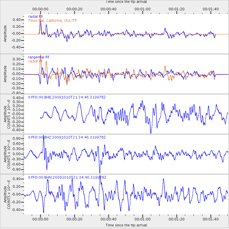
Signal To Noise
| Channel | StoN | STA | LTA |
| II:PFO:00:BHZ:20091010T21:34:46.319978Z | 3.3230302 | 4.2971453E-7 | 1.2931406E-7 |
| II:PFO:00:BHN:20091010T21:34:46.319978Z | 2.4575193 | 2.1082367E-7 | 8.5787185E-8 |
| II:PFO:00:BHE:20091010T21:34:46.319978Z | 1.189893 | 1.2855816E-7 | 1.0804179E-7 |
| Arrivals |
| Ps | |
| PpPs | |
| PsPs/PpSs | |


