You are here: Home > Network List > TA - USArray Transportable Network (new EarthScope stations) Stations List
> Station MDND Maddock, ND, USA > Earthquake Result Viewer
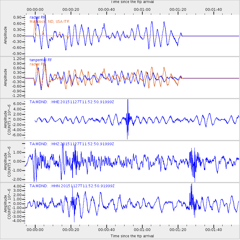
MDND Maddock, ND, USA - Earthquake Result Viewer
*The percent match for this event was below the threshold and hence no stack was calculated.
| Earthquake location: |
El Salvador |
| Earthquake latitude/longitude: |
13.1/-88.9 |
| Earthquake time(UTC): |
2015/11/27 (331) 11:46:27 GMT |
| Earthquake Depth: |
52 km |
| Earthquake Magnitude: |
5.6 MWW, 5.5 MWB, 5.5 MWR, 5.5 MWC |
| Earthquake Catalog/Contributor: |
NEIC PDE/NEIC COMCAT |
|
| Network: |
TA USArray Transportable Network (new EarthScope stations) |
| Station: |
MDND Maddock, ND, USA |
| Lat/Lon: |
47.85 N/99.60 W |
| Elevation: |
479 m |
|
| Distance: |
35.8 deg |
| Az: |
347.699 deg |
| Baz: |
162.051 deg |
| Ray Param: |
$rayparam |
*The percent match for this event was below the threshold and hence was not used in the summary stack. |
|
| Radial Match: |
70.24972 % |
| Radial Bump: |
400 |
| Transverse Match: |
55.47075 % |
| Transverse Bump: |
359 |
| SOD ConfigId: |
7422571 |
| Insert Time: |
2019-04-21 12:19:47.021 +0000 |
| GWidth: |
2.5 |
| Max Bumps: |
400 |
| Tol: |
0.001 |
|
Signal To Noise
| Channel | StoN | STA | LTA |
| TA:MDND: :HHZ:20151127T11:52:50.91999Z | 2.804381 | 9.0417245E-7 | 3.2241428E-7 |
| TA:MDND: :HHN:20151127T11:52:50.91999Z | 0.41539073 | 5.7870557E-7 | 1.3931594E-6 |
| TA:MDND: :HHE:20151127T11:52:50.91999Z | 0.59270215 | 3.9100456E-7 | 6.596983E-7 |
| Arrivals |
| Ps | |
| PpPs | |
| PsPs/PpSs | |


