
KMI Kunming, Yunnan Province, China - Earthquake Result Viewer
| ||||||||||||||||||
| ||||||||||||||||||
| ||||||||||||||||||
|
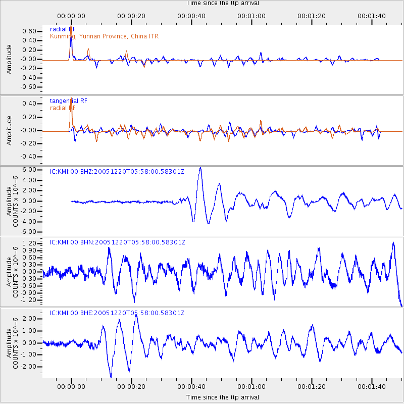
Signal To Noise
| Channel | StoN | STA | LTA |
| IC:KMI:00:BHN:20051220T05:58:00.58301Z | 1.3356636 | 1.5986225E-7 | 1.1968751E-7 |
| IC:KMI:00:BHE:20051220T05:58:00.58301Z | 1.7236859 | 1.7714684E-7 | 1.0277211E-7 |
| IC:KMI:00:BHZ:20051220T05:58:00.58301Z | 2.0280213 | 2.0075699E-7 | 9.8991556E-8 |
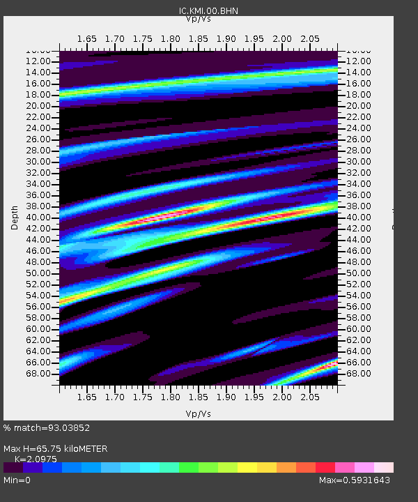
| Arrivals | |
| Ps | 12 SECOND |
| PpPs | 31 SECOND |
| PsPs/PpSs | 43 SECOND |

