You are here: Home > Network List > US - United States National Seismic Network Stations List
> Station EGMT Eagleton, Montana, USA > Earthquake Result Viewer
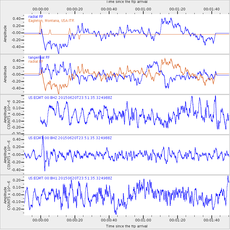
EGMT Eagleton, Montana, USA - Earthquake Result Viewer
*The percent match for this event was below the threshold and hence no stack was calculated.
| Earthquake location: |
South Of Fiji Islands |
| Earthquake latitude/longitude: |
-23.6/-177.1 |
| Earthquake time(UTC): |
2015/06/20 (171) 23:39:09 GMT |
| Earthquake Depth: |
158 km |
| Earthquake Magnitude: |
5.9 MO |
| Earthquake Catalog/Contributor: |
NEIC PDE/NEIC ALERT |
|
| Network: |
US United States National Seismic Network |
| Station: |
EGMT Eagleton, Montana, USA |
| Lat/Lon: |
48.02 N/109.75 W |
| Elevation: |
1055 m |
|
| Distance: |
93.3 deg |
| Az: |
38.354 deg |
| Baz: |
238.017 deg |
| Ray Param: |
$rayparam |
*The percent match for this event was below the threshold and hence was not used in the summary stack. |
|
| Radial Match: |
60.919933 % |
| Radial Bump: |
400 |
| Transverse Match: |
40.417206 % |
| Transverse Bump: |
400 |
| SOD ConfigId: |
976571 |
| Insert Time: |
2015-07-05 00:10:35.708 +0000 |
| GWidth: |
2.5 |
| Max Bumps: |
400 |
| Tol: |
0.001 |
|
Signal To Noise
| Channel | StoN | STA | LTA |
| US:EGMT:00:BHZ:20150620T23:51:35.324988Z | 3.7198443 | 2.112894E-7 | 5.6800605E-8 |
| US:EGMT:00:BH1:20150620T23:51:35.324988Z | 0.65526795 | 1.219527E-7 | 1.8611118E-7 |
| US:EGMT:00:BH2:20150620T23:51:35.324988Z | 0.53207487 | 5.5518548E-8 | 1.04343485E-7 |
| Arrivals |
| Ps | |
| PpPs | |
| PsPs/PpSs | |


