You are here: Home > Network List > TA - USArray Transportable Network (new EarthScope stations) Stations List
> Station J05D Fort Rock, OR, USA > Earthquake Result Viewer
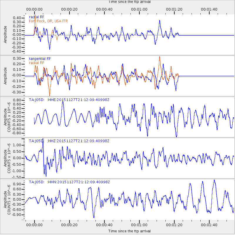
J05D Fort Rock, OR, USA - Earthquake Result Viewer
*The percent match for this event was below the threshold and hence no stack was calculated.
| Earthquake location: |
Near Coast Of Northern Chile |
| Earthquake latitude/longitude: |
-24.8/-70.6 |
| Earthquake time(UTC): |
2015/11/27 (331) 21:00:22 GMT |
| Earthquake Depth: |
35 km |
| Earthquake Magnitude: |
6.2 MWW, 6.2 MWB |
| Earthquake Catalog/Contributor: |
NEIC PDE/NEIC COMCAT |
|
| Network: |
TA USArray Transportable Network (new EarthScope stations) |
| Station: |
J05D Fort Rock, OR, USA |
| Lat/Lon: |
43.28 N/121.23 W |
| Elevation: |
1541 m |
|
| Distance: |
82.2 deg |
| Az: |
325.278 deg |
| Baz: |
134.862 deg |
| Ray Param: |
$rayparam |
*The percent match for this event was below the threshold and hence was not used in the summary stack. |
|
| Radial Match: |
45.83738 % |
| Radial Bump: |
366 |
| Transverse Match: |
49.952374 % |
| Transverse Bump: |
369 |
| SOD ConfigId: |
7422571 |
| Insert Time: |
2019-04-21 12:29:19.370 +0000 |
| GWidth: |
2.5 |
| Max Bumps: |
400 |
| Tol: |
0.001 |
|
Signal To Noise
| Channel | StoN | STA | LTA |
| TA:J05D: :HHZ:20151127T21:12:09.40998Z | 2.581109 | 5.112275E-7 | 1.9806504E-7 |
| TA:J05D: :HHN:20151127T21:12:09.40998Z | 0.61501384 | 1.9734433E-7 | 3.208779E-7 |
| TA:J05D: :HHE:20151127T21:12:09.40998Z | 0.8872446 | 2.4441658E-7 | 2.7547824E-7 |
| Arrivals |
| Ps | |
| PpPs | |
| PsPs/PpSs | |


