You are here: Home > Network List > TA - USArray Transportable Network (new EarthScope stations) Stations List
> Station T25A Trinidad, CO, USA > Earthquake Result Viewer
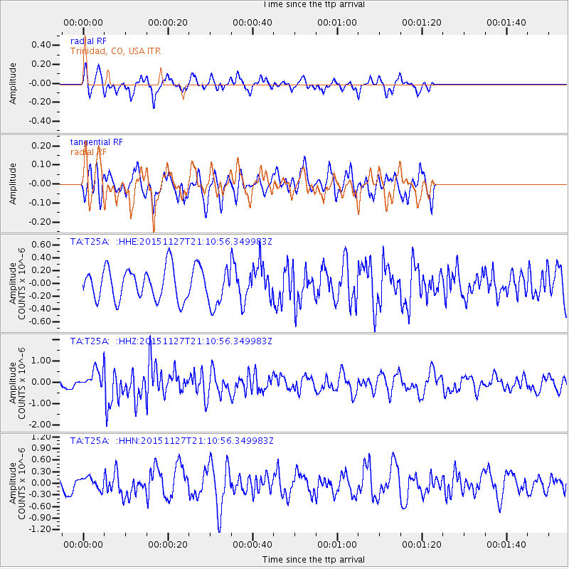
T25A Trinidad, CO, USA - Earthquake Result Viewer
*The percent match for this event was below the threshold and hence no stack was calculated.
| Earthquake location: |
Near Coast Of Northern Chile |
| Earthquake latitude/longitude: |
-24.8/-70.6 |
| Earthquake time(UTC): |
2015/11/27 (331) 21:00:22 GMT |
| Earthquake Depth: |
35 km |
| Earthquake Magnitude: |
6.2 MWW, 6.2 MWB |
| Earthquake Catalog/Contributor: |
NEIC PDE/NEIC COMCAT |
|
| Network: |
TA USArray Transportable Network (new EarthScope stations) |
| Station: |
T25A Trinidad, CO, USA |
| Lat/Lon: |
37.14 N/104.41 W |
| Elevation: |
2017 m |
|
| Distance: |
69.3 deg |
| Az: |
331.653 deg |
| Baz: |
147.322 deg |
| Ray Param: |
$rayparam |
*The percent match for this event was below the threshold and hence was not used in the summary stack. |
|
| Radial Match: |
55.110294 % |
| Radial Bump: |
378 |
| Transverse Match: |
69.20537 % |
| Transverse Bump: |
395 |
| SOD ConfigId: |
7422571 |
| Insert Time: |
2019-04-21 12:29:43.747 +0000 |
| GWidth: |
2.5 |
| Max Bumps: |
400 |
| Tol: |
0.001 |
|
Signal To Noise
| Channel | StoN | STA | LTA |
| TA:T25A: :HHZ:20151127T21:10:56.349983Z | 2.1916537 | 4.92544E-7 | 2.2473624E-7 |
| TA:T25A: :HHN:20151127T21:10:56.349983Z | 0.74755347 | 1.5059456E-7 | 2.0144988E-7 |
| TA:T25A: :HHE:20151127T21:10:56.349983Z | 1.1594087 | 2.864589E-7 | 2.4707327E-7 |
| Arrivals |
| Ps | |
| PpPs | |
| PsPs/PpSs | |


