You are here: Home > Network List > UW - Pacific Northwest Regional Seismic Network Stations List
> Station LEBA Lebam, WA, USA > Earthquake Result Viewer
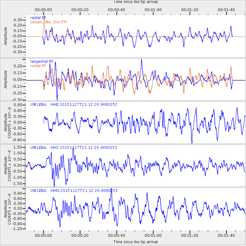
LEBA Lebam, WA, USA - Earthquake Result Viewer
*The percent match for this event was below the threshold and hence no stack was calculated.
| Earthquake location: |
Near Coast Of Northern Chile |
| Earthquake latitude/longitude: |
-24.8/-70.6 |
| Earthquake time(UTC): |
2015/11/27 (331) 21:00:22 GMT |
| Earthquake Depth: |
35 km |
| Earthquake Magnitude: |
6.2 MWW, 6.2 MWB |
| Earthquake Catalog/Contributor: |
NEIC PDE/NEIC COMCAT |
|
| Network: |
UW Pacific Northwest Regional Seismic Network |
| Station: |
LEBA Lebam, WA, USA |
| Lat/Lon: |
46.55 N/123.56 W |
| Elevation: |
73 m |
|
| Distance: |
85.6 deg |
| Az: |
326.474 deg |
| Baz: |
133.35 deg |
| Ray Param: |
$rayparam |
*The percent match for this event was below the threshold and hence was not used in the summary stack. |
|
| Radial Match: |
53.663982 % |
| Radial Bump: |
400 |
| Transverse Match: |
56.143993 % |
| Transverse Bump: |
400 |
| SOD ConfigId: |
7422571 |
| Insert Time: |
2019-04-21 12:30:24.888 +0000 |
| GWidth: |
2.5 |
| Max Bumps: |
400 |
| Tol: |
0.001 |
|
Signal To Noise
| Channel | StoN | STA | LTA |
| UW:LEBA: :HHZ:20151127T21:12:26.968025Z | 1.9740047 | 5.2251175E-7 | 2.6469633E-7 |
| UW:LEBA: :HHN:20151127T21:12:26.968025Z | 0.96219087 | 2.0943403E-7 | 2.1766371E-7 |
| UW:LEBA: :HHE:20151127T21:12:26.968025Z | 1.0293624 | 2.3580691E-7 | 2.2908054E-7 |
| Arrivals |
| Ps | |
| PpPs | |
| PsPs/PpSs | |


