KMI Kunming, Yunnan Province, China - Earthquake Result Viewer
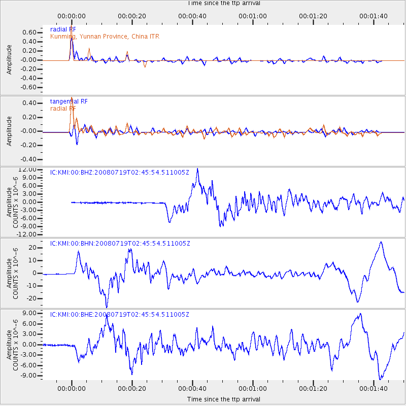
Earthquake location: Off East Coast Of Honshu, Japan
Earthquake latitude/longitude: 37.6/142.2
Earthquake time(UTC): 2008/07/19 (201) 02:39:28 GMT
Earthquake Depth: 22 km
Earthquake Magnitude: 6.2 MB, 7.0 MS, 7.0 MW, 6.9 MW
Earthquake Catalog/Contributor: WHDF/NEIC
Network: IC New China Digital Seismograph Network
Station: KMI Kunming, Yunnan Province, China
Lat/Lon: 25.12 N/102.74 E
Elevation: 1975 m
Distance: 35.7 deg
Az: 261.212 deg
Baz: 60.051 deg
Ray Param: 0.07706805
Estimated Moho Depth: 42.75 km
Estimated Crust Vp/Vs: 1.88
Assumed Crust Vp: 6.247 km/s
Estimated Crust Vs: 3.318 km/s
Estimated Crust Poisson's Ratio: 0.30
Radial Match: 93.11495 %
Radial Bump: 370
Transverse Match: 65.25344 %
Transverse Bump: 400
SOD ConfigId: 2504
Insert Time: 2010-03-04 22:28:55.541 +0000
GWidth: 2.5
Max Bumps: 400
Tol: 0.001

Signal To Noise

ChannelStoNSTALTA
IC:KMI:00:BHN:20080719T02:45:54.511005Z73.606497.710927E-61.047588E-7
IC:KMI:00:BHE:20080719T02:45:54.511005Z23.0804522.6319005E-61.14031586E-7
IC:KMI:00:BHZ:20080719T02:45:54.511005Z38.7383773.6498498E-69.421793E-8
Arrivals
Ps6.5 SECOND
PpPs18 SECOND
PsPs/PpSs25 SECOND