
KMI Kunming, Yunnan Province, China - Earthquake Result Viewer
| ||||||||||||||||||
| ||||||||||||||||||
| ||||||||||||||||||
|
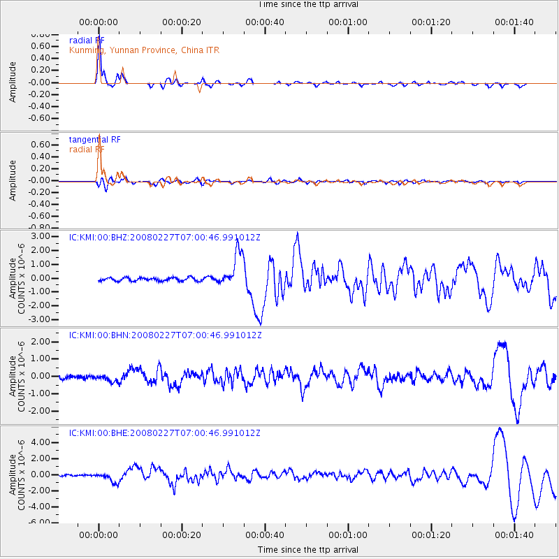
Signal To Noise
| Channel | StoN | STA | LTA |
| IC:KMI:00:BHN:20080227T07:00:46.991012Z | 1.8394502 | 2.0470125E-7 | 1.11283924E-7 |
| IC:KMI:00:BHE:20080227T07:00:46.991012Z | 7.909442 | 6.6796565E-7 | 8.445168E-8 |
| IC:KMI:00:BHZ:20080227T07:00:46.991012Z | 11.359242 | 1.3403995E-6 | 1.18000784E-7 |
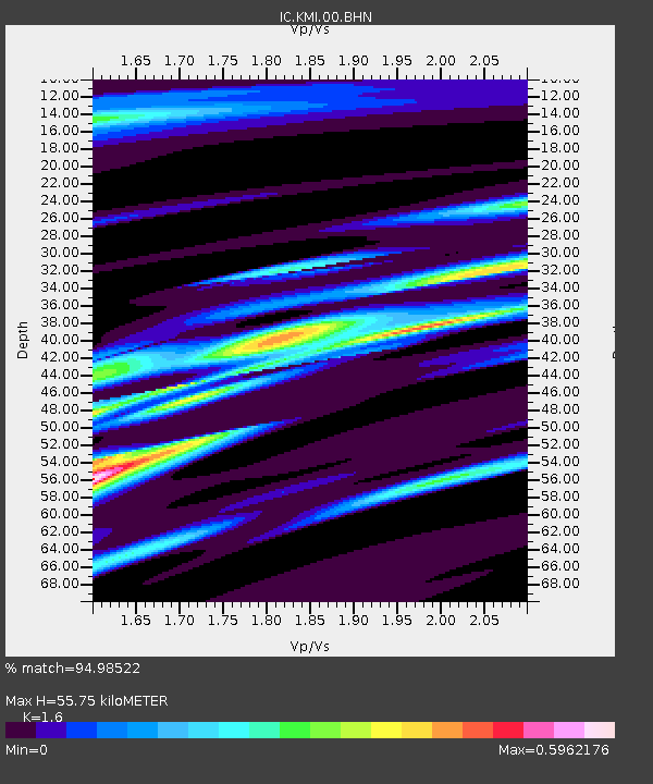
| Arrivals | |
| Ps | 5.8 SECOND |
| PpPs | 21 SECOND |
| PsPs/PpSs | 27 SECOND |

