You are here: Home > Network List > KN - Kyrgyz Seismic Telemetry Network Stations List
> Station CHM KN.CHM > Earthquake Result Viewer
CHM KN.CHM - Earthquake Result Viewer
*The percent match for this event was below the threshold and hence no stack was calculated.
| Earthquake location: |
Kuril Islands |
| Earthquake latitude/longitude: |
43.3/146.5 |
| Earthquake time(UTC): |
2015/11/28 (332) 02:51:06 GMT |
| Earthquake Depth: |
60 km |
| Earthquake Magnitude: |
5.9 MB |
| Earthquake Catalog/Contributor: |
NEIC PDE/NEIC COMCAT |
|
| Network: |
KN Kyrgyz Seismic Telemetry Network |
| Station: |
CHM KN.CHM |
| Lat/Lon: |
43.00 N/74.75 E |
| Elevation: |
655 m |
|
| Distance: |
50.8 deg |
| Az: |
295.913 deg |
| Baz: |
63.438 deg |
| Ray Param: |
$rayparam |
*The percent match for this event was below the threshold and hence was not used in the summary stack. |
|
| Radial Match: |
54.187305 % |
| Radial Bump: |
400 |
| Transverse Match: |
41.53654 % |
| Transverse Bump: |
400 |
| SOD ConfigId: |
7422571 |
| Insert Time: |
2019-04-21 12:36:51.931 +0000 |
| GWidth: |
2.5 |
| Max Bumps: |
400 |
| Tol: |
0.001 |
|
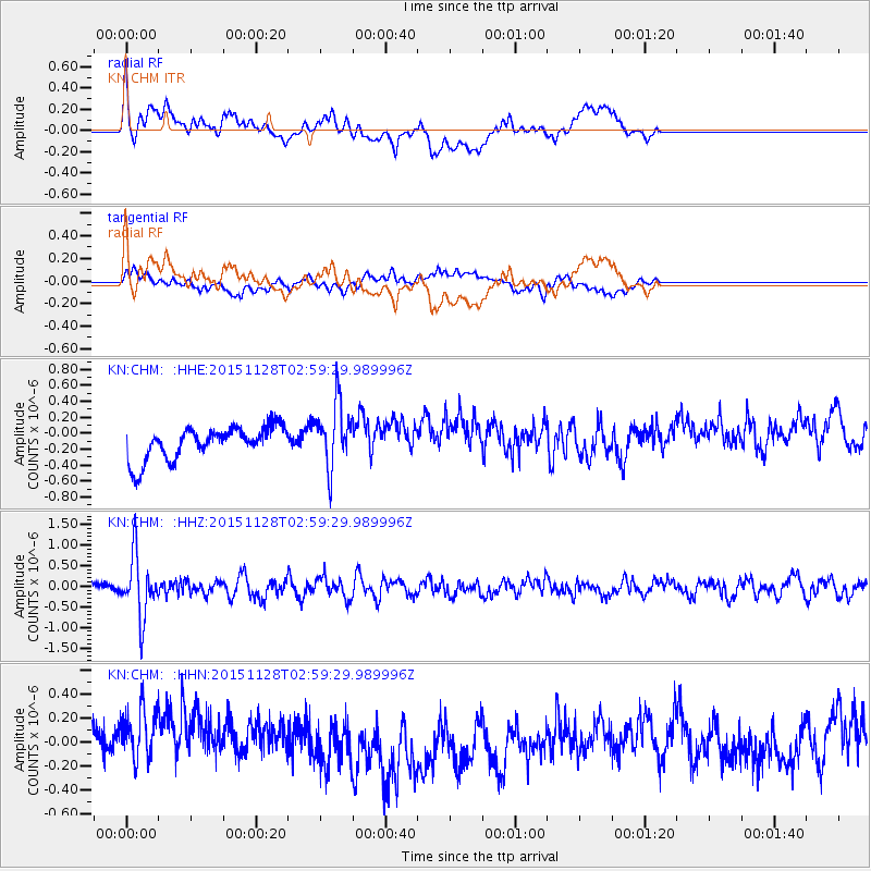
Signal To Noise
| Channel | StoN | STA | LTA |
| KN:CHM: :HHZ:20151128T02:59:29.989996Z | 5.9341655 | 7.391364E-7 | 1.2455608E-7 |
| KN:CHM: :HHN:20151128T02:59:29.989996Z | 1.5543833 | 2.9035388E-7 | 1.8679683E-7 |
| KN:CHM: :HHE:20151128T02:59:29.989996Z | 2.0246127 | 4.1279097E-7 | 2.038864E-7 |
| Arrivals |
| Ps | |
| PpPs | |
| PsPs/PpSs | |


