KMI Kunming, Yunnan Province, China - Earthquake Result Viewer
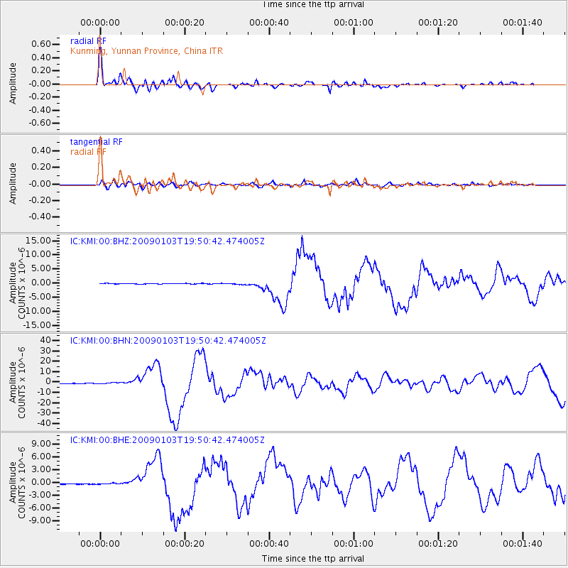
Earthquake location: Irian Jaya Region, Indonesia
Earthquake latitude/longitude: -0.4/132.9
Earthquake time(UTC): 2009/01/03 (003) 19:43:50 GMT
Earthquake Depth: 17 km
Earthquake Magnitude: 6.6 MB, 7.5 MS, 7.6 MW, 7.6 MW
Earthquake Catalog/Contributor: WHDF/NEIC
Network: IC New China Digital Seismograph Network
Station: KMI Kunming, Yunnan Province, China
Lat/Lon: 25.12 N/102.74 E
Elevation: 1975 m
Distance: 38.7 deg
Az: 313.224 deg
Baz: 126.503 deg
Ray Param: 0.075414486
Estimated Moho Depth: 37.5 km
Estimated Crust Vp/Vs: 2.08
Assumed Crust Vp: 6.247 km/s
Estimated Crust Vs: 3.01 km/s
Estimated Crust Poisson's Ratio: 0.35
Radial Match: 93.71512 %
Radial Bump: 400
Transverse Match: 76.30965 %
Transverse Bump: 400
SOD ConfigId: 2834
Insert Time: 2010-03-04 22:29:51.781 +0000
GWidth: 2.5
Max Bumps: 400
Tol: 0.001

Signal To Noise

ChannelStoNSTALTA
IC:KMI:00:BHN:20090103T19:50:42.474005Z6.0635565.575665E-79.1953716E-8
IC:KMI:00:BHE:20090103T19:50:42.474005Z1.0226691.10717906E-71.0826367E-7
IC:KMI:00:BHZ:20090103T19:50:42.474005Z2.3633492.2651759E-79.584602E-8
Arrivals
Ps6.8 SECOND
PpPs17 SECOND
PsPs/PpSs24 SECOND