KMI Kunming, Yunnan Province, China - Earthquake Result Viewer
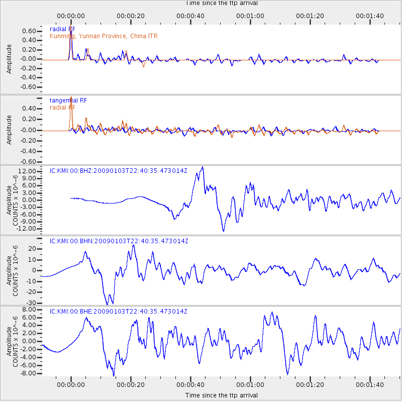
Earthquake location: Irian Jaya Region, Indonesia
Earthquake latitude/longitude: -0.7/133.3
Earthquake time(UTC): 2009/01/03 (003) 22:33:40 GMT
Earthquake Depth: 23 km
Earthquake Magnitude: 6.7 MB, 7.4 MS, 7.4 MW, 7.3 MW
Earthquake Catalog/Contributor: WHDF/NEIC
Network: IC New China Digital Seismograph Network
Station: KMI Kunming, Yunnan Province, China
Lat/Lon: 25.12 N/102.74 E
Elevation: 1975 m
Distance: 39.2 deg
Az: 313.113 deg
Baz: 126.365 deg
Ray Param: 0.075112544
Estimated Moho Depth: 33.25 km
Estimated Crust Vp/Vs: 1.91
Assumed Crust Vp: 6.247 km/s
Estimated Crust Vs: 3.275 km/s
Estimated Crust Poisson's Ratio: 0.31
Radial Match: 93.405716 %
Radial Bump: 400
Transverse Match: 72.57466 %
Transverse Bump: 400
SOD ConfigId: 2834
Insert Time: 2010-03-04 22:29:53.755 +0000
GWidth: 2.5
Max Bumps: 400
Tol: 0.001

Signal To Noise

ChannelStoNSTALTA
IC:KMI:00:BHN:20090103T22:40:35.473014Z3.02407439.018802E-62.9823348E-6
IC:KMI:00:BHE:20090103T22:40:35.473014Z1.40179112.536528E-61.8094905E-6
IC:KMI:00:BHZ:20090103T22:40:35.473014Z4.33894633.907303E-69.005188E-7
Arrivals
Ps5.1 SECOND
PpPs15 SECOND
PsPs/PpSs20 SECOND