You are here: Home > Network List > TA - USArray Transportable Network (new EarthScope stations) Stations List
> Station G03D McMinnville, OR, USA > Earthquake Result Viewer
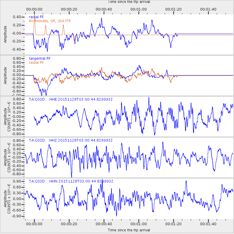
G03D McMinnville, OR, USA - Earthquake Result Viewer
*The percent match for this event was below the threshold and hence no stack was calculated.
| Earthquake location: |
Kuril Islands |
| Earthquake latitude/longitude: |
43.3/146.5 |
| Earthquake time(UTC): |
2015/11/28 (332) 02:51:06 GMT |
| Earthquake Depth: |
60 km |
| Earthquake Magnitude: |
5.9 MB |
| Earthquake Catalog/Contributor: |
NEIC PDE/NEIC COMCAT |
|
| Network: |
TA USArray Transportable Network (new EarthScope stations) |
| Station: |
G03D McMinnville, OR, USA |
| Lat/Lon: |
45.21 N/123.26 W |
| Elevation: |
222 m |
|
| Distance: |
61.2 deg |
| Az: |
53.756 deg |
| Baz: |
303.654 deg |
| Ray Param: |
$rayparam |
*The percent match for this event was below the threshold and hence was not used in the summary stack. |
|
| Radial Match: |
54.002274 % |
| Radial Bump: |
400 |
| Transverse Match: |
54.64093 % |
| Transverse Bump: |
400 |
| SOD ConfigId: |
7422571 |
| Insert Time: |
2019-04-21 12:39:48.480 +0000 |
| GWidth: |
2.5 |
| Max Bumps: |
400 |
| Tol: |
0.001 |
|
Signal To Noise
| Channel | StoN | STA | LTA |
| TA:G03D: :HHZ:20151128T03:00:44.829993Z | 0.89982015 | 1.7731242E-7 | 1.9705315E-7 |
| TA:G03D: :HHN:20151128T03:00:44.829993Z | 0.96369404 | 2.4355305E-7 | 2.527286E-7 |
| TA:G03D: :HHE:20151128T03:00:44.829993Z | 1.9913288 | 3.5948958E-7 | 1.8052748E-7 |
| Arrivals |
| Ps | |
| PpPs | |
| PsPs/PpSs | |


