You are here: Home > Network List > TA - USArray Transportable Network (new EarthScope stations) Stations List
> Station J20K Nowitna River, AK, USA > Earthquake Result Viewer
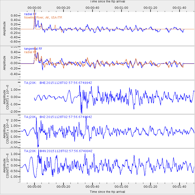
J20K Nowitna River, AK, USA - Earthquake Result Viewer
*The percent match for this event was below the threshold and hence no stack was calculated.
| Earthquake location: |
Kuril Islands |
| Earthquake latitude/longitude: |
43.3/146.5 |
| Earthquake time(UTC): |
2015/11/28 (332) 02:51:06 GMT |
| Earthquake Depth: |
60 km |
| Earthquake Magnitude: |
5.9 MB |
| Earthquake Catalog/Contributor: |
NEIC PDE/NEIC COMCAT |
|
| Network: |
TA USArray Transportable Network (new EarthScope stations) |
| Station: |
J20K Nowitna River, AK, USA |
| Lat/Lon: |
64.18 N/154.15 W |
| Elevation: |
314 m |
|
| Distance: |
39.0 deg |
| Az: |
36.827 deg |
| Baz: |
266.843 deg |
| Ray Param: |
$rayparam |
*The percent match for this event was below the threshold and hence was not used in the summary stack. |
|
| Radial Match: |
59.484367 % |
| Radial Bump: |
400 |
| Transverse Match: |
71.88807 % |
| Transverse Bump: |
400 |
| SOD ConfigId: |
7422571 |
| Insert Time: |
2019-04-21 12:39:55.672 +0000 |
| GWidth: |
2.5 |
| Max Bumps: |
400 |
| Tol: |
0.001 |
|
Signal To Noise
| Channel | StoN | STA | LTA |
| TA:J20K: :BHZ:20151128T02:57:56.674994Z | 5.184143 | 1.2680459E-6 | 2.4460087E-7 |
| TA:J20K: :BHN:20151128T02:57:56.674994Z | 3.4141514 | 7.350174E-7 | 2.1528554E-7 |
| TA:J20K: :BHE:20151128T02:57:56.674994Z | 2.910655 | 8.5145757E-7 | 2.9253127E-7 |
| Arrivals |
| Ps | |
| PpPs | |
| PsPs/PpSs | |


