You are here: Home > Network List > TA - USArray Transportable Network (new EarthScope stations) Stations List
> Station X43A Marvell, AR, USA > Earthquake Result Viewer
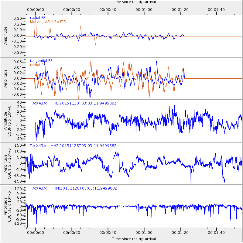
X43A Marvell, AR, USA - Earthquake Result Viewer
*The percent match for this event was below the threshold and hence no stack was calculated.
| Earthquake location: |
Kuril Islands |
| Earthquake latitude/longitude: |
43.3/146.5 |
| Earthquake time(UTC): |
2015/11/28 (332) 02:51:06 GMT |
| Earthquake Depth: |
60 km |
| Earthquake Magnitude: |
5.9 MB |
| Earthquake Catalog/Contributor: |
NEIC PDE/NEIC COMCAT |
|
| Network: |
TA USArray Transportable Network (new EarthScope stations) |
| Station: |
X43A Marvell, AR, USA |
| Lat/Lon: |
34.52 N/90.88 W |
| Elevation: |
53 m |
|
| Distance: |
86.5 deg |
| Az: |
44.158 deg |
| Baz: |
322.01 deg |
| Ray Param: |
$rayparam |
*The percent match for this event was below the threshold and hence was not used in the summary stack. |
|
| Radial Match: |
52.486706 % |
| Radial Bump: |
400 |
| Transverse Match: |
63.101906 % |
| Transverse Bump: |
400 |
| SOD ConfigId: |
7422571 |
| Insert Time: |
2019-04-21 12:40:16.325 +0000 |
| GWidth: |
2.5 |
| Max Bumps: |
400 |
| Tol: |
0.001 |
|
Signal To Noise
| Channel | StoN | STA | LTA |
| TA:X43A: :HHZ:20151128T03:03:11.949988Z | 0.6263622 | 2.3720047E-5 | 3.7869537E-5 |
| TA:X43A: :HHN:20151128T03:03:11.949988Z | 2.6387587 | 2.6079204E-5 | 9.883133E-6 |
| TA:X43A: :HHE:20151128T03:03:11.949988Z | 0.92708844 | 1.2210071E-5 | 1.3170341E-5 |
| Arrivals |
| Ps | |
| PpPs | |
| PsPs/PpSs | |


