KMI Kunming, Yunnan Province, China - Earthquake Result Viewer
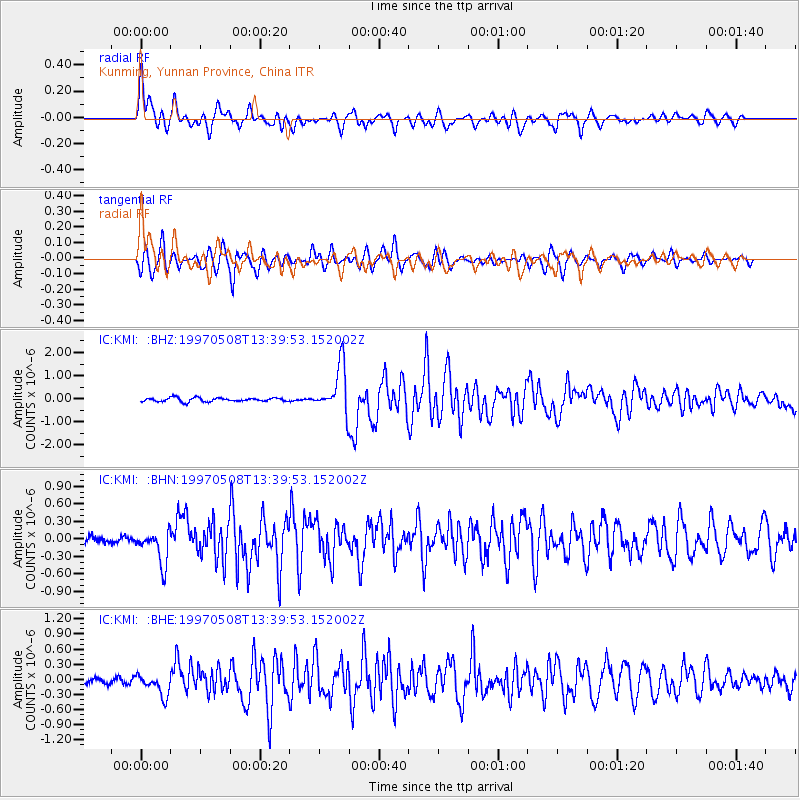
Earthquake location: Fox Islands, Aleutian Islands
Earthquake latitude/longitude: 51.7/-170.8
Earthquake time(UTC): 1997/05/08 (128) 13:29:24 GMT
Earthquake Depth: 33 km
Earthquake Magnitude: 5.8 MB, 5.9 MS, 6.0 UNKNOWN, 6.0 MW
Earthquake Catalog/Contributor: WHDF/NEIC
Network: IC New China Digital Seismograph Network
Station: KMI Kunming, Yunnan Province, China
Lat/Lon: 25.12 N/102.74 E
Elevation: 1975 m
Distance: 68.6 deg
Az: 283.599 deg
Baz: 41.839 deg
Ray Param: 0.05616787
Estimated Moho Depth: 42.0 km
Estimated Crust Vp/Vs: 1.81
Assumed Crust Vp: 6.247 km/s
Estimated Crust Vs: 3.461 km/s
Estimated Crust Poisson's Ratio: 0.28
Radial Match: 92.15531 %
Radial Bump: 400
Transverse Match: 88.10903 %
Transverse Bump: 400
SOD ConfigId: 6273
Insert Time: 2010-03-04 22:30:31.291 +0000
GWidth: 2.5
Max Bumps: 400
Tol: 0.001

Signal To Noise

ChannelStoNSTALTA
IC:KMI: :BHN:19970508T13:39:53.152002Z3.7754372.909427E-77.706198E-8
IC:KMI: :BHE:19970508T13:39:53.152002Z3.86293862.083367E-75.393218E-8
IC:KMI: :BHZ:19970508T13:39:53.152002Z12.144261.0183635E-68.385554E-8
Arrivals
Ps5.6 SECOND
PpPs18 SECOND
PsPs/PpSs24 SECOND