You are here: Home > Network List > TA - USArray Transportable Network (new EarthScope stations) Stations List
> Station TUL1 Leonard, OK, USA > Earthquake Result Viewer
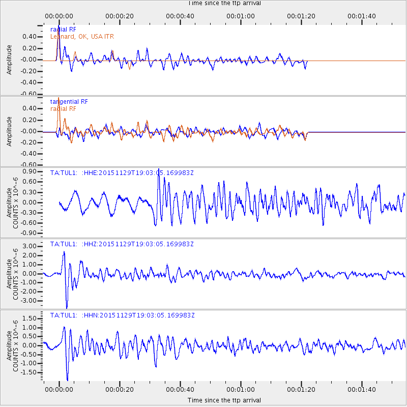
TUL1 Leonard, OK, USA - Earthquake Result Viewer
*The percent match for this event was below the threshold and hence no stack was calculated.
| Earthquake location: |
Jujuy Province, Argentina |
| Earthquake latitude/longitude: |
-23.5/-64.6 |
| Earthquake time(UTC): |
2015/11/29 (333) 18:52:49 GMT |
| Earthquake Depth: |
9.6 km |
| Earthquake Magnitude: |
5.9 MWP |
| Earthquake Catalog/Contributor: |
NEIC PDE/NEIC COMCAT |
|
| Network: |
TA USArray Transportable Network (new EarthScope stations) |
| Station: |
TUL1 Leonard, OK, USA |
| Lat/Lon: |
35.91 N/95.79 W |
| Elevation: |
256 m |
|
| Distance: |
66.1 deg |
| Az: |
332.621 deg |
| Baz: |
148.675 deg |
| Ray Param: |
$rayparam |
*The percent match for this event was below the threshold and hence was not used in the summary stack. |
|
| Radial Match: |
78.945114 % |
| Radial Bump: |
325 |
| Transverse Match: |
61.225864 % |
| Transverse Bump: |
400 |
| SOD ConfigId: |
7422571 |
| Insert Time: |
2019-04-21 12:57:54.393 +0000 |
| GWidth: |
2.5 |
| Max Bumps: |
400 |
| Tol: |
0.001 |
|
Signal To Noise
| Channel | StoN | STA | LTA |
| TA:TUL1: :HHZ:20151129T19:03:05.169983Z | 11.565076 | 1.5358024E-6 | 1.3279657E-7 |
| TA:TUL1: :HHN:20151129T19:03:05.169983Z | 5.340877 | 7.913044E-7 | 1.4816E-7 |
| TA:TUL1: :HHE:20151129T19:03:05.169983Z | 2.4143064 | 4.4906415E-7 | 1.8600132E-7 |
| Arrivals |
| Ps | |
| PpPs | |
| PsPs/PpSs | |


