You are here: Home > Network List > TA - USArray Transportable Network (new EarthScope stations) Stations List
> Station W41B Gary Mavity, Velonia, AR, USA > Earthquake Result Viewer
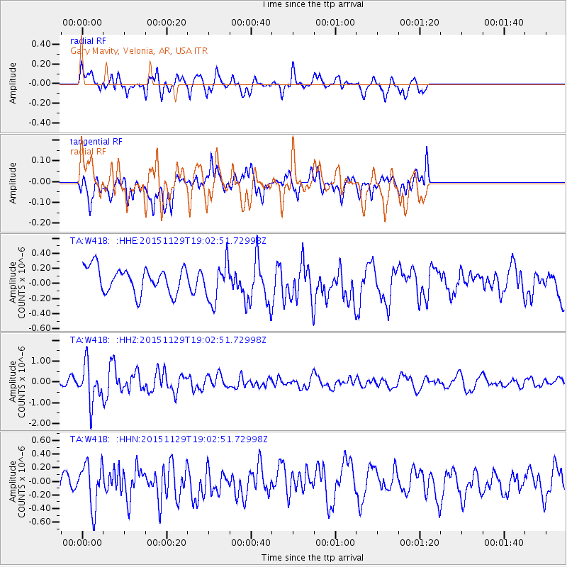
W41B Gary Mavity, Velonia, AR, USA - Earthquake Result Viewer
*The percent match for this event was below the threshold and hence no stack was calculated.
| Earthquake location: |
Jujuy Province, Argentina |
| Earthquake latitude/longitude: |
-23.5/-64.6 |
| Earthquake time(UTC): |
2015/11/29 (333) 18:52:49 GMT |
| Earthquake Depth: |
9.6 km |
| Earthquake Magnitude: |
5.9 MWP |
| Earthquake Catalog/Contributor: |
NEIC PDE/NEIC COMCAT |
|
| Network: |
TA USArray Transportable Network (new EarthScope stations) |
| Station: |
W41B Gary Mavity, Velonia, AR, USA |
| Lat/Lon: |
35.17 N/92.25 W |
| Elevation: |
95 m |
|
| Distance: |
64.0 deg |
| Az: |
334.985 deg |
| Baz: |
151.724 deg |
| Ray Param: |
$rayparam |
*The percent match for this event was below the threshold and hence was not used in the summary stack. |
|
| Radial Match: |
62.337063 % |
| Radial Bump: |
400 |
| Transverse Match: |
50.99981 % |
| Transverse Bump: |
400 |
| SOD ConfigId: |
7422571 |
| Insert Time: |
2019-04-21 12:57:57.410 +0000 |
| GWidth: |
2.5 |
| Max Bumps: |
400 |
| Tol: |
0.001 |
|
Signal To Noise
| Channel | StoN | STA | LTA |
| TA:W41B: :HHZ:20151129T19:02:51.72998Z | 4.622299 | 9.4431994E-7 | 2.0429658E-7 |
| TA:W41B: :HHN:20151129T19:02:51.72998Z | 1.4189578 | 3.314732E-7 | 2.3360327E-7 |
| TA:W41B: :HHE:20151129T19:02:51.72998Z | 1.6047368 | 2.6588202E-7 | 1.6568576E-7 |
| Arrivals |
| Ps | |
| PpPs | |
| PsPs/PpSs | |


