You are here: Home > Network List > US - United States National Seismic Network Stations List
> Station MNTX Cornudas Mountains, Texas, USA > Earthquake Result Viewer
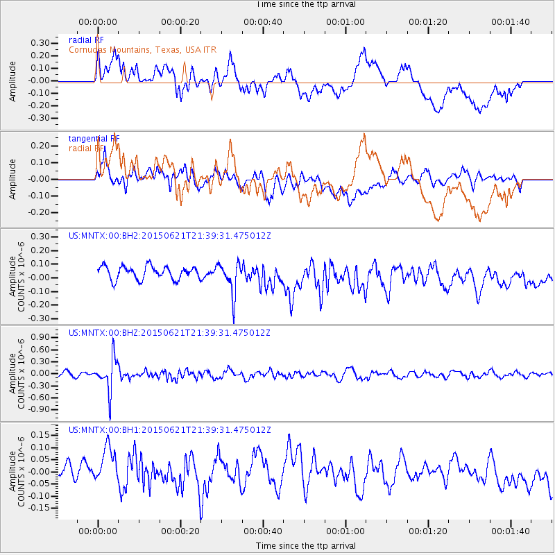
MNTX Cornudas Mountains, Texas, USA - Earthquake Result Viewer
*The percent match for this event was below the threshold and hence no stack was calculated.
| Earthquake location: |
Fiji Islands Region |
| Earthquake latitude/longitude: |
-20.5/-178.4 |
| Earthquake time(UTC): |
2015/06/21 (172) 21:28:16 GMT |
| Earthquake Depth: |
563 km |
| Earthquake Magnitude: |
6.5 MO |
| Earthquake Catalog/Contributor: |
NEIC PDE/NEIC ALERT |
|
| Network: |
US United States National Seismic Network |
| Station: |
MNTX Cornudas Mountains, Texas, USA |
| Lat/Lon: |
31.70 N/105.38 W |
| Elevation: |
404 m |
|
| Distance: |
87.0 deg |
| Az: |
54.7 deg |
| Baz: |
243.874 deg |
| Ray Param: |
$rayparam |
*The percent match for this event was below the threshold and hence was not used in the summary stack. |
|
| Radial Match: |
17.679039 % |
| Radial Bump: |
400 |
| Transverse Match: |
45.703617 % |
| Transverse Bump: |
400 |
| SOD ConfigId: |
976571 |
| Insert Time: |
2015-07-05 21:55:01.173 +0000 |
| GWidth: |
2.5 |
| Max Bumps: |
400 |
| Tol: |
0.001 |
|
Signal To Noise
| Channel | StoN | STA | LTA |
| US:MNTX:00:BHZ:20150621T21:39:31.475012Z | 6.441891 | 4.2284478E-7 | 6.5639846E-8 |
| US:MNTX:00:BH1:20150621T21:39:31.475012Z | 1.9881294 | 1.0888016E-7 | 5.4765128E-8 |
| US:MNTX:00:BH2:20150621T21:39:31.475012Z | 2.5724363 | 1.2222802E-7 | 4.7514494E-8 |
| Arrivals |
| Ps | |
| PpPs | |
| PsPs/PpSs | |


