You are here: Home > Network List > UW - Pacific Northwest Regional Seismic Network Stations List
> Station PASS Maple Falls, WA, USA > Earthquake Result Viewer
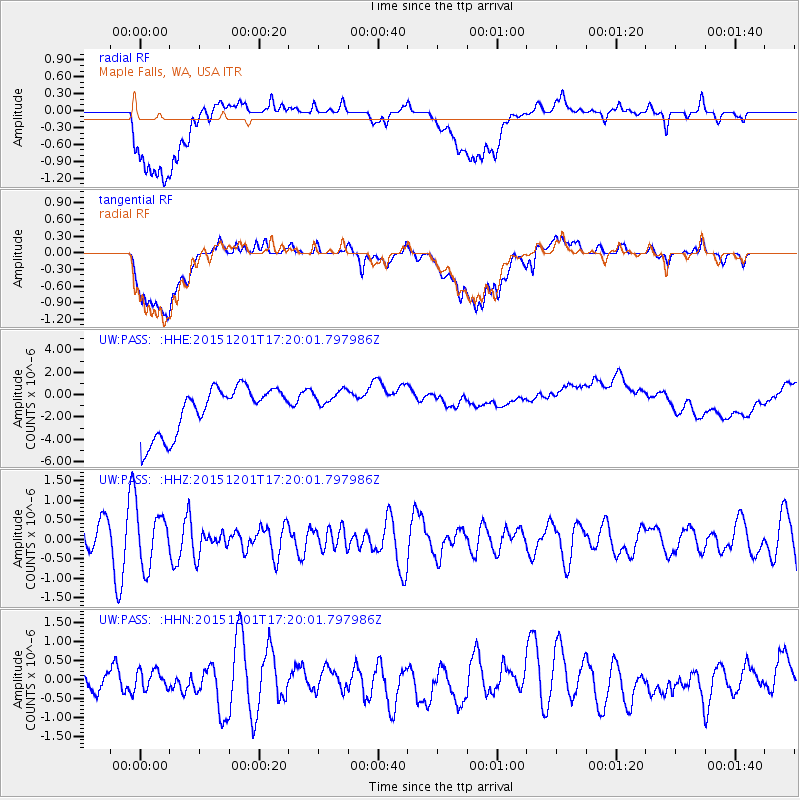
PASS Maple Falls, WA, USA - Earthquake Result Viewer
*The percent match for this event was below the threshold and hence no stack was calculated.
| Earthquake location: |
Fiji Islands Region |
| Earthquake latitude/longitude: |
-14.9/-176.6 |
| Earthquake time(UTC): |
2015/12/01 (335) 17:08:25 GMT |
| Earthquake Depth: |
10 km |
| Earthquake Magnitude: |
5.6 MB |
| Earthquake Catalog/Contributor: |
NEIC PDE/NEIC COMCAT |
|
| Network: |
UW Pacific Northwest Regional Seismic Network |
| Station: |
PASS Maple Falls, WA, USA |
| Lat/Lon: |
49.00 N/122.09 W |
| Elevation: |
174 m |
|
| Distance: |
79.8 deg |
| Az: |
33.016 deg |
| Baz: |
233.109 deg |
| Ray Param: |
$rayparam |
*The percent match for this event was below the threshold and hence was not used in the summary stack. |
|
| Radial Match: |
28.994387 % |
| Radial Bump: |
400 |
| Transverse Match: |
29.33549 % |
| Transverse Bump: |
400 |
| SOD ConfigId: |
7422571 |
| Insert Time: |
2019-04-21 13:17:07.309 +0000 |
| GWidth: |
2.5 |
| Max Bumps: |
400 |
| Tol: |
0.001 |
|
Signal To Noise
| Channel | StoN | STA | LTA |
| UW:PASS: :HHZ:20151201T17:20:01.797986Z | 1.1959064 | 6.805739E-7 | 5.690863E-7 |
| UW:PASS: :HHN:20151201T17:20:01.797986Z | 0.57672524 | 2.5601634E-7 | 4.4391388E-7 |
| UW:PASS: :HHE:20151201T17:20:01.797986Z | 0.59330785 | 1.1262009E-6 | 1.8981731E-6 |
| Arrivals |
| Ps | |
| PpPs | |
| PsPs/PpSs | |


