You are here: Home > Network List > IC - New China Digital Seismograph Network Stations List
> Station KMI Kunming, Yunnan Province, China > Earthquake Result Viewer
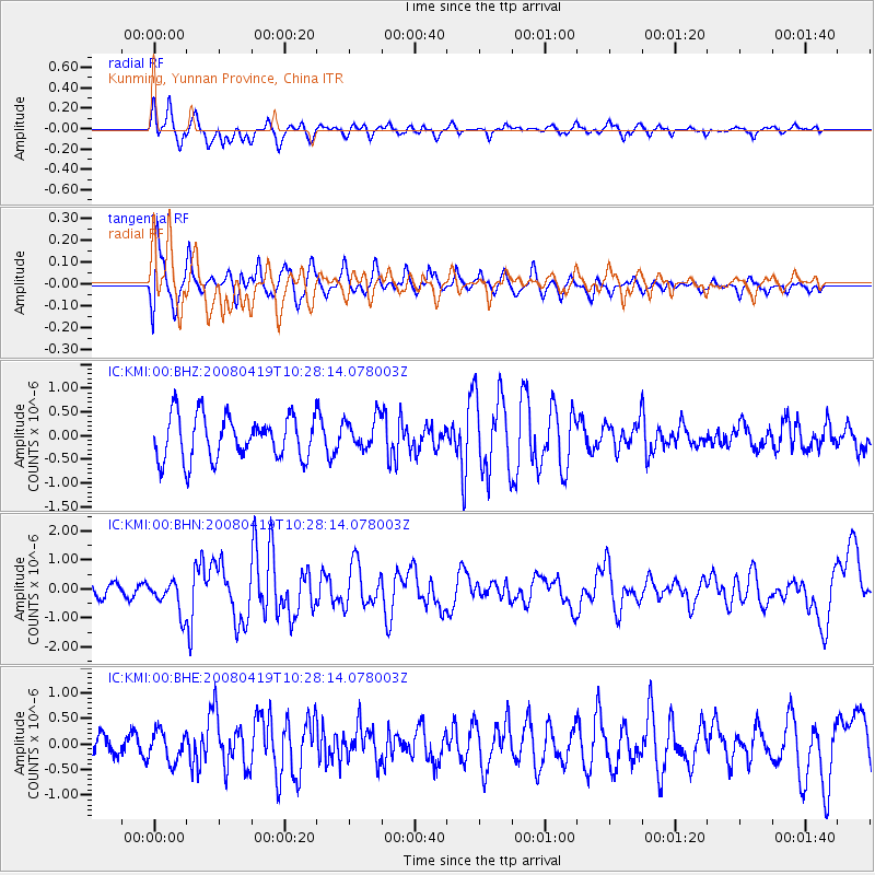
KMI Kunming, Yunnan Province, China - Earthquake Result Viewer
*The percent match for this event was below the threshold and hence no stack was calculated.
| Earthquake location: |
Banda Sea |
| Earthquake latitude/longitude: |
-7.9/125.7 |
| Earthquake time(UTC): |
2008/04/19 (110) 10:21:12 GMT |
| Earthquake Depth: |
10 km |
| Earthquake Magnitude: |
5.6 MB, 5.6 MS, 6.0 MW, 6.0 MW |
| Earthquake Catalog/Contributor: |
WHDF/NEIC |
|
| Network: |
IC New China Digital Seismograph Network |
| Station: |
KMI Kunming, Yunnan Province, China |
| Lat/Lon: |
25.12 N/102.74 E |
| Elevation: |
1975 m |
|
| Distance: |
39.7 deg |
| Az: |
326.36 deg |
| Baz: |
142.74 deg |
| Ray Param: |
$rayparam |
*The percent match for this event was below the threshold and hence was not used in the summary stack. |
|
| Radial Match: |
69.12131 % |
| Radial Bump: |
400 |
| Transverse Match: |
57.065456 % |
| Transverse Bump: |
400 |
| SOD ConfigId: |
2504 |
| Insert Time: |
2010-03-04 22:35:43.361 +0000 |
| GWidth: |
2.5 |
| Max Bumps: |
400 |
| Tol: |
0.001 |
|
Signal To Noise
| Channel | StoN | STA | LTA |
| IC:KMI:00:BHN:20080419T10:28:14.078003Z | 1.4384581 | 5.657535E-7 | 3.9330553E-7 |
| IC:KMI:00:BHE:20080419T10:28:14.078003Z | 1.0604526 | 2.9780307E-7 | 2.808264E-7 |
| IC:KMI:00:BHZ:20080419T10:28:14.078003Z | 0.7237845 | 3.3030855E-7 | 4.5636313E-7 |
| Arrivals |
| Ps | |
| PpPs | |
| PsPs/PpSs | |


