You are here: Home > Network List > IC - New China Digital Seismograph Network Stations List
> Station KMI Kunming, Yunnan Province, China > Earthquake Result Viewer
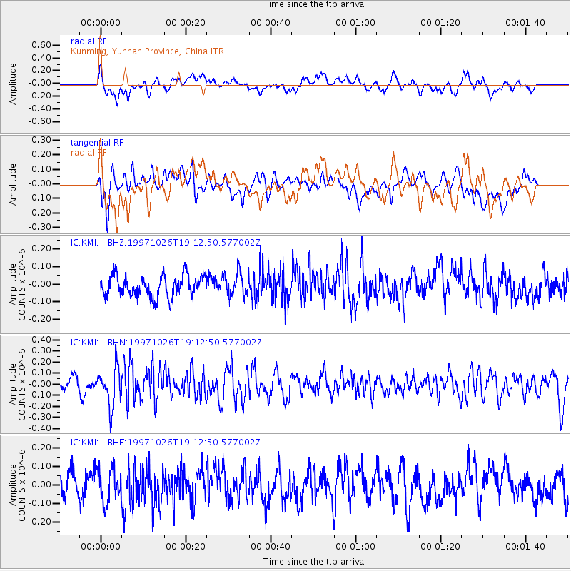
KMI Kunming, Yunnan Province, China - Earthquake Result Viewer
*The percent match for this event was below the threshold and hence no stack was calculated.
| Earthquake location: |
Eastern Honshu, Japan |
| Earthquake latitude/longitude: |
39.3/140.5 |
| Earthquake time(UTC): |
1997/10/26 (299) 19:06:44 GMT |
| Earthquake Depth: |
134 km |
| Earthquake Magnitude: |
5.6 UNKNOWN, 5.2 MB |
| Earthquake Catalog/Contributor: |
WHDF/NEIC |
|
| Network: |
IC New China Digital Seismograph Network |
| Station: |
KMI Kunming, Yunnan Province, China |
| Lat/Lon: |
25.12 N/102.74 E |
| Elevation: |
1975 m |
|
| Distance: |
34.6 deg |
| Az: |
257.333 deg |
| Baz: |
56.634 deg |
| Ray Param: |
$rayparam |
*The percent match for this event was below the threshold and hence was not used in the summary stack. |
|
| Radial Match: |
67.38629 % |
| Radial Bump: |
400 |
| Transverse Match: |
59.805153 % |
| Transverse Bump: |
400 |
| SOD ConfigId: |
4480 |
| Insert Time: |
2010-03-04 22:35:47.294 +0000 |
| GWidth: |
2.5 |
| Max Bumps: |
400 |
| Tol: |
0.001 |
|
Signal To Noise
| Channel | StoN | STA | LTA |
| IC:KMI: :BHN:19971026T19:12:50.577002Z | 3.8661697 | 1.8105018E-7 | 4.6829342E-8 |
| IC:KMI: :BHE:19971026T19:12:50.577002Z | 1.6626385 | 8.794019E-8 | 5.2891945E-8 |
| IC:KMI: :BHZ:19971026T19:12:50.577002Z | 1.1411353 | 6.8412206E-8 | 5.9951E-8 |
| Arrivals |
| Ps | |
| PpPs | |
| PsPs/PpSs | |


