You are here: Home > Network List > IC - New China Digital Seismograph Network Stations List
> Station KMI Kunming, Yunnan Province, China > Earthquake Result Viewer
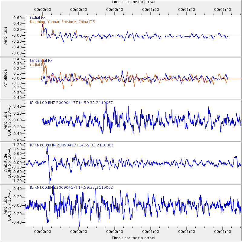
KMI Kunming, Yunnan Province, China - Earthquake Result Viewer
*The percent match for this event was below the threshold and hence no stack was calculated.
| Earthquake location: |
Kuril Islands |
| Earthquake latitude/longitude: |
46.2/151.7 |
| Earthquake time(UTC): |
2009/04/17 (107) 14:51:58 GMT |
| Earthquake Depth: |
49 km |
| Earthquake Magnitude: |
5.5 MB, 5.0 MS, 5.7 MW, 5.6 MW |
| Earthquake Catalog/Contributor: |
WHDF/NEIC |
|
| Network: |
IC New China Digital Seismograph Network |
| Station: |
KMI Kunming, Yunnan Province, China |
| Lat/Lon: |
25.12 N/102.74 E |
| Elevation: |
1975 m |
|
| Distance: |
44.2 deg |
| Az: |
258.872 deg |
| Baz: |
48.785 deg |
| Ray Param: |
$rayparam |
*The percent match for this event was below the threshold and hence was not used in the summary stack. |
|
| Radial Match: |
73.37889 % |
| Radial Bump: |
400 |
| Transverse Match: |
67.79939 % |
| Transverse Bump: |
400 |
| SOD ConfigId: |
2760 |
| Insert Time: |
2010-03-04 22:36:15.200 +0000 |
| GWidth: |
2.5 |
| Max Bumps: |
400 |
| Tol: |
0.001 |
|
Signal To Noise
| Channel | StoN | STA | LTA |
| IC:KMI:00:BHN:20090417T14:59:32.211006Z | 7.6058145 | 5.9932125E-7 | 7.8797775E-8 |
| IC:KMI:00:BHE:20090417T14:59:32.211006Z | 2.6787674 | 1.8757734E-7 | 7.002375E-8 |
| IC:KMI:00:BHZ:20090417T14:59:32.211006Z | 2.178525 | 1.8714253E-7 | 8.590332E-8 |
| Arrivals |
| Ps | |
| PpPs | |
| PsPs/PpSs | |


