You are here: Home > Network List > IC - New China Digital Seismograph Network Stations List
> Station KMI Kunming, Yunnan Province, China > Earthquake Result Viewer
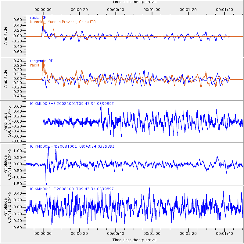
KMI Kunming, Yunnan Province, China - Earthquake Result Viewer
*The percent match for this event was below the threshold and hence no stack was calculated.
| Earthquake location: |
Southeast Of Honshu, Japan |
| Earthquake latitude/longitude: |
30.2/138.8 |
| Earthquake time(UTC): |
2008/10/01 (275) 09:38:12 GMT |
| Earthquake Depth: |
414 km |
| Earthquake Magnitude: |
5.7 MW, 5.1 MB, 5.7 MW |
| Earthquake Catalog/Contributor: |
WHDF/NEIC |
|
| Network: |
IC New China Digital Seismograph Network |
| Station: |
KMI Kunming, Yunnan Province, China |
| Lat/Lon: |
25.12 N/102.74 E |
| Elevation: |
1975 m |
|
| Distance: |
32.2 deg |
| Az: |
269.914 deg |
| Baz: |
72.82 deg |
| Ray Param: |
$rayparam |
*The percent match for this event was below the threshold and hence was not used in the summary stack. |
|
| Radial Match: |
66.391945 % |
| Radial Bump: |
400 |
| Transverse Match: |
63.132072 % |
| Transverse Bump: |
400 |
| SOD ConfigId: |
2556 |
| Insert Time: |
2010-03-04 22:36:34.272 +0000 |
| GWidth: |
2.5 |
| Max Bumps: |
400 |
| Tol: |
0.001 |
|
Signal To Noise
| Channel | StoN | STA | LTA |
| IC:KMI:00:BHN:20081001T09:43:34.033989Z | 7.2406764 | 6.025689E-7 | 8.321997E-8 |
| IC:KMI:00:BHE:20081001T09:43:34.033989Z | 2.294592 | 2.2275117E-7 | 9.7076594E-8 |
| IC:KMI:00:BHZ:20081001T09:43:34.033989Z | 2.8548756 | 2.3730297E-7 | 8.3122E-8 |
| Arrivals |
| Ps | |
| PpPs | |
| PsPs/PpSs | |


