You are here: Home > Network List > AZ - ANZA Regional Network Stations List
> Station SMER AZ.SMER > Earthquake Result Viewer
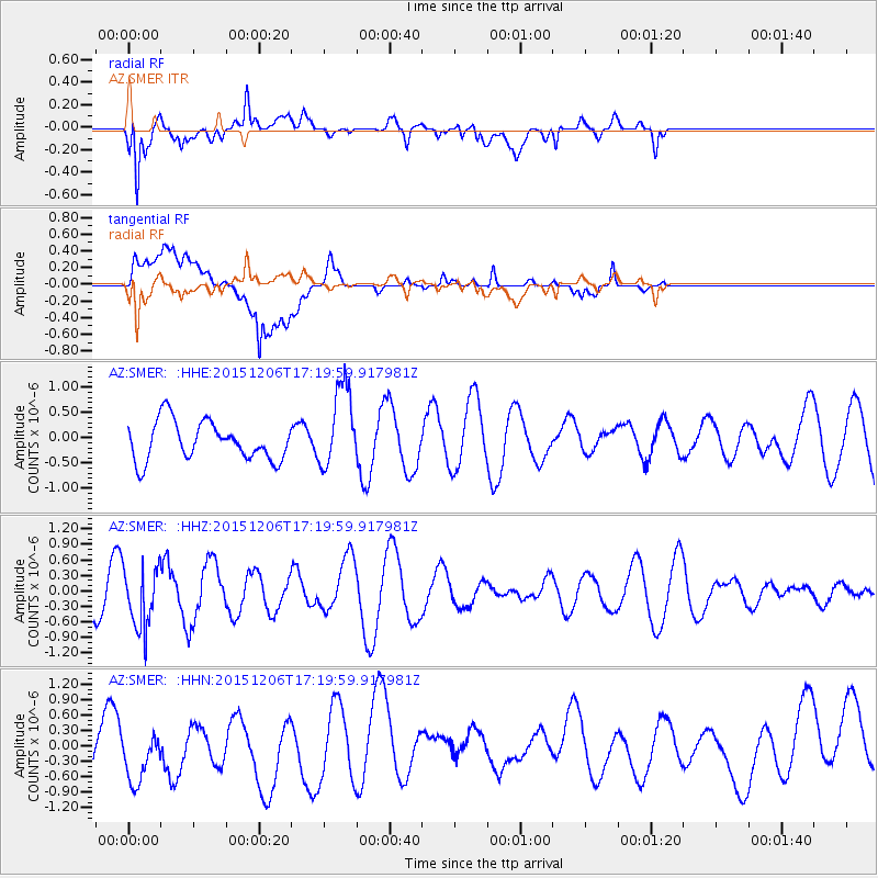
SMER AZ.SMER - Earthquake Result Viewer
*The percent match for this event was below the threshold and hence no stack was calculated.
| Earthquake location: |
Fiji Islands Region |
| Earthquake latitude/longitude: |
-18.2/-178.7 |
| Earthquake time(UTC): |
2015/12/06 (340) 17:09:28 GMT |
| Earthquake Depth: |
544 km |
| Earthquake Magnitude: |
5.8 MB |
| Earthquake Catalog/Contributor: |
NEIC PDE/NEIC COMCAT |
|
| Network: |
AZ ANZA Regional Network |
| Station: |
SMER AZ.SMER |
| Lat/Lon: |
33.46 N/117.17 W |
| Elevation: |
355 m |
|
| Distance: |
77.9 deg |
| Az: |
48.704 deg |
| Baz: |
238.688 deg |
| Ray Param: |
$rayparam |
*The percent match for this event was below the threshold and hence was not used in the summary stack. |
|
| Radial Match: |
80.7746 % |
| Radial Bump: |
400 |
| Transverse Match: |
55.223408 % |
| Transverse Bump: |
400 |
| SOD ConfigId: |
7422571 |
| Insert Time: |
2019-04-21 13:24:15.730 +0000 |
| GWidth: |
2.5 |
| Max Bumps: |
400 |
| Tol: |
0.001 |
|
Signal To Noise
| Channel | StoN | STA | LTA |
| AZ:SMER: :HHZ:20151206T17:19:59.917981Z | 1.8708023 | 5.920542E-7 | 3.1647076E-7 |
| AZ:SMER: :HHN:20151206T17:19:59.917981Z | 0.7611393 | 5.2963793E-7 | 6.958489E-7 |
| AZ:SMER: :HHE:20151206T17:19:59.917981Z | 2.132286 | 8.1654946E-7 | 3.8294556E-7 |
| Arrivals |
| Ps | |
| PpPs | |
| PsPs/PpSs | |


