You are here: Home > Network List > TA - USArray Transportable Network (new EarthScope stations) Stations List
> Station MSTX Muleshoe, TX, USA > Earthquake Result Viewer
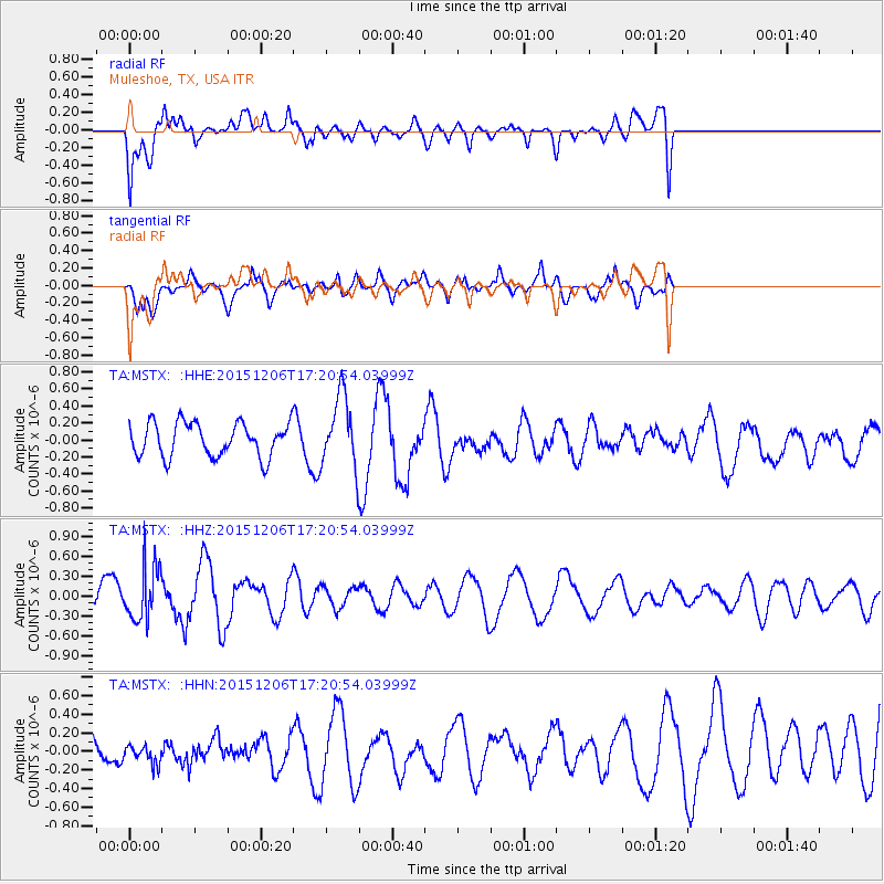
MSTX Muleshoe, TX, USA - Earthquake Result Viewer
*The percent match for this event was below the threshold and hence no stack was calculated.
| Earthquake location: |
Fiji Islands Region |
| Earthquake latitude/longitude: |
-18.2/-178.7 |
| Earthquake time(UTC): |
2015/12/06 (340) 17:09:28 GMT |
| Earthquake Depth: |
544 km |
| Earthquake Magnitude: |
5.8 MB |
| Earthquake Catalog/Contributor: |
NEIC PDE/NEIC COMCAT |
|
| Network: |
TA USArray Transportable Network (new EarthScope stations) |
| Station: |
MSTX Muleshoe, TX, USA |
| Lat/Lon: |
33.97 N/102.77 W |
| Elevation: |
1167 m |
|
| Distance: |
88.9 deg |
| Az: |
53.728 deg |
| Baz: |
247.252 deg |
| Ray Param: |
$rayparam |
*The percent match for this event was below the threshold and hence was not used in the summary stack. |
|
| Radial Match: |
59.888622 % |
| Radial Bump: |
400 |
| Transverse Match: |
52.93171 % |
| Transverse Bump: |
400 |
| SOD ConfigId: |
7422571 |
| Insert Time: |
2019-04-21 13:27:37.968 +0000 |
| GWidth: |
2.5 |
| Max Bumps: |
400 |
| Tol: |
0.001 |
|
Signal To Noise
| Channel | StoN | STA | LTA |
| TA:MSTX: :HHZ:20151206T17:20:54.03999Z | 2.035938 | 4.0609663E-7 | 1.9946415E-7 |
| TA:MSTX: :HHN:20151206T17:20:54.03999Z | 0.90077156 | 1.4852235E-7 | 1.6488347E-7 |
| TA:MSTX: :HHE:20151206T17:20:54.03999Z | 2.0608034 | 4.037958E-7 | 1.9594097E-7 |
| Arrivals |
| Ps | |
| PpPs | |
| PsPs/PpSs | |


