You are here: Home > Network List > TA - USArray Transportable Network (new EarthScope stations) Stations List
> Station O18K Koktuh Hills, AK, USA > Earthquake Result Viewer
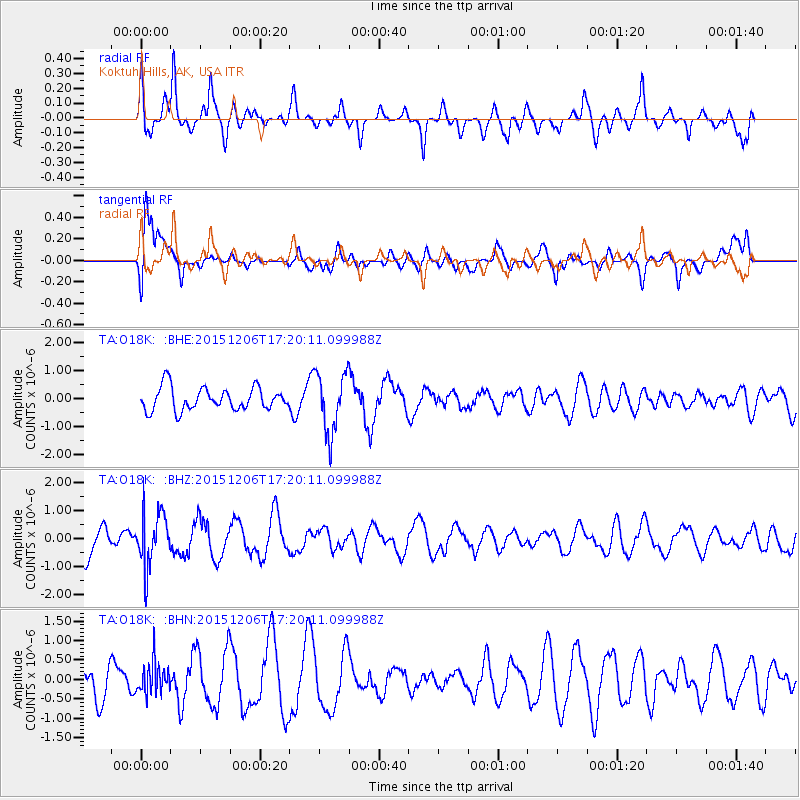
O18K Koktuh Hills, AK, USA - Earthquake Result Viewer
*The percent match for this event was below the threshold and hence no stack was calculated.
| Earthquake location: |
Fiji Islands Region |
| Earthquake latitude/longitude: |
-18.2/-178.7 |
| Earthquake time(UTC): |
2015/12/06 (340) 17:09:28 GMT |
| Earthquake Depth: |
544 km |
| Earthquake Magnitude: |
5.8 MB |
| Earthquake Catalog/Contributor: |
NEIC PDE/NEIC COMCAT |
|
| Network: |
TA USArray Transportable Network (new EarthScope stations) |
| Station: |
O18K Koktuh Hills, AK, USA |
| Lat/Lon: |
59.85 N/155.21 W |
| Elevation: |
544 m |
|
| Distance: |
80.1 deg |
| Az: |
11.776 deg |
| Baz: |
202.606 deg |
| Ray Param: |
$rayparam |
*The percent match for this event was below the threshold and hence was not used in the summary stack. |
|
| Radial Match: |
72.4582 % |
| Radial Bump: |
400 |
| Transverse Match: |
65.11097 % |
| Transverse Bump: |
400 |
| SOD ConfigId: |
7422571 |
| Insert Time: |
2019-04-21 13:27:39.727 +0000 |
| GWidth: |
2.5 |
| Max Bumps: |
400 |
| Tol: |
0.001 |
|
Signal To Noise
| Channel | StoN | STA | LTA |
| TA:O18K: :BHZ:20151206T17:20:11.099988Z | 1.5792458 | 9.410693E-7 | 5.958979E-7 |
| TA:O18K: :BHN:20151206T17:20:11.099988Z | 0.73576325 | 4.072476E-7 | 5.535036E-7 |
| TA:O18K: :BHE:20151206T17:20:11.099988Z | 2.6303852 | 1.0642306E-6 | 4.0459116E-7 |
| Arrivals |
| Ps | |
| PpPs | |
| PsPs/PpSs | |


