You are here: Home > Network List > TA - USArray Transportable Network (new EarthScope stations) Stations List
> Station TPFO Pinon Flats, CA, USA > Earthquake Result Viewer
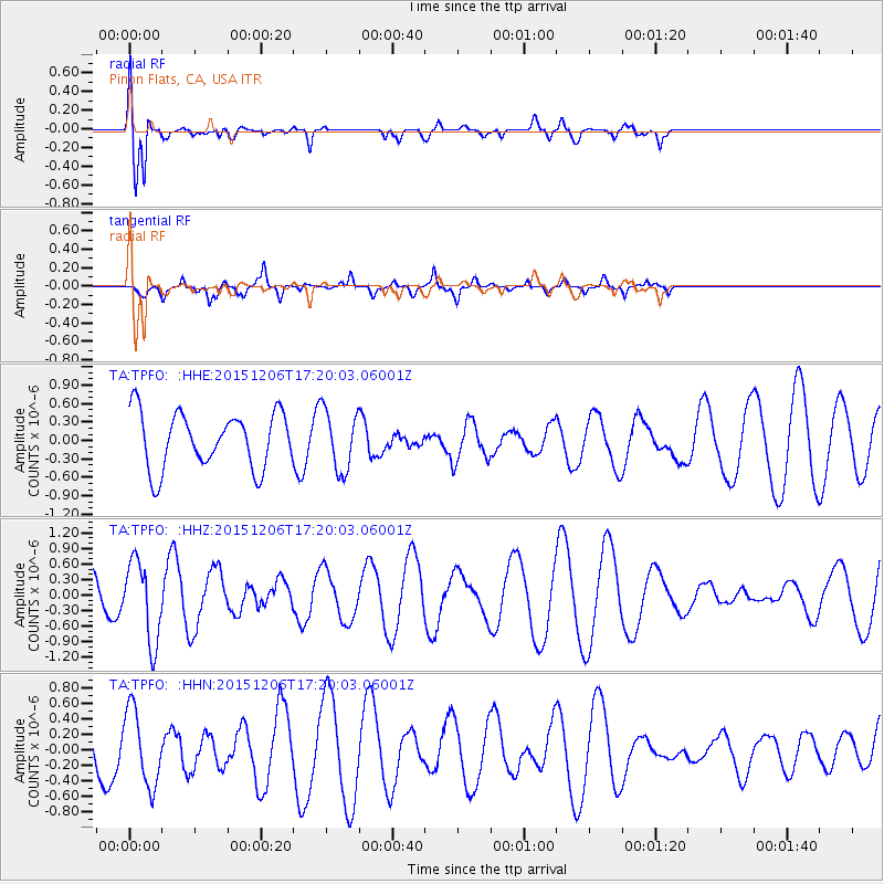
TPFO Pinon Flats, CA, USA - Earthquake Result Viewer
*The percent match for this event was below the threshold and hence no stack was calculated.
| Earthquake location: |
Fiji Islands Region |
| Earthquake latitude/longitude: |
-18.2/-178.7 |
| Earthquake time(UTC): |
2015/12/06 (340) 17:09:28 GMT |
| Earthquake Depth: |
544 km |
| Earthquake Magnitude: |
5.8 MB |
| Earthquake Catalog/Contributor: |
NEIC PDE/NEIC COMCAT |
|
| Network: |
TA USArray Transportable Network (new EarthScope stations) |
| Station: |
TPFO Pinon Flats, CA, USA |
| Lat/Lon: |
33.61 N/116.45 W |
| Elevation: |
1275 m |
|
| Distance: |
78.5 deg |
| Az: |
48.89 deg |
| Baz: |
239.12 deg |
| Ray Param: |
$rayparam |
*The percent match for this event was below the threshold and hence was not used in the summary stack. |
|
| Radial Match: |
75.32982 % |
| Radial Bump: |
400 |
| Transverse Match: |
72.57996 % |
| Transverse Bump: |
392 |
| SOD ConfigId: |
7422571 |
| Insert Time: |
2019-04-21 13:27:44.815 +0000 |
| GWidth: |
2.5 |
| Max Bumps: |
400 |
| Tol: |
0.001 |
|
Signal To Noise
| Channel | StoN | STA | LTA |
| TA:TPFO: :HHZ:20151206T17:20:03.06001Z | 1.7554141 | 7.7332595E-7 | 4.405376E-7 |
| TA:TPFO: :HHN:20151206T17:20:03.06001Z | 1.5254091 | 4.878785E-7 | 3.1983456E-7 |
| TA:TPFO: :HHE:20151206T17:20:03.06001Z | 1.0969119 | 4.981184E-7 | 4.5410977E-7 |
| Arrivals |
| Ps | |
| PpPs | |
| PsPs/PpSs | |


