You are here: Home > Network List > IC - New China Digital Seismograph Network Stations List
> Station KMI Kunming, Yunnan Province, China > Earthquake Result Viewer
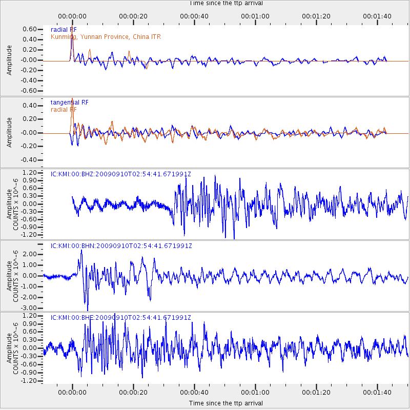
KMI Kunming, Yunnan Province, China - Earthquake Result Viewer
*The percent match for this event was below the threshold and hence no stack was calculated.
| Earthquake location: |
Kuril Islands |
| Earthquake latitude/longitude: |
48.3/154.2 |
| Earthquake time(UTC): |
2009/09/10 (253) 02:46:50 GMT |
| Earthquake Depth: |
36 km |
| Earthquake Magnitude: |
6.0 MB, 5.5 MS, 6.0 MW, 5.8 MW |
| Earthquake Catalog/Contributor: |
WHDF/NEIC |
|
| Network: |
IC New China Digital Seismograph Network |
| Station: |
KMI Kunming, Yunnan Province, China |
| Lat/Lon: |
25.12 N/102.74 E |
| Elevation: |
1975 m |
|
| Distance: |
46.3 deg |
| Az: |
258.924 deg |
| Baz: |
46.273 deg |
| Ray Param: |
$rayparam |
*The percent match for this event was below the threshold and hence was not used in the summary stack. |
|
| Radial Match: |
78.18113 % |
| Radial Bump: |
400 |
| Transverse Match: |
74.80786 % |
| Transverse Bump: |
400 |
| SOD ConfigId: |
2622 |
| Insert Time: |
2010-03-04 22:36:51.362 +0000 |
| GWidth: |
2.5 |
| Max Bumps: |
400 |
| Tol: |
0.001 |
|
Signal To Noise
| Channel | StoN | STA | LTA |
| IC:KMI:00:BHN:20090910T02:54:41.671991Z | 6.1720943 | 1.1178741E-6 | 1.8111747E-7 |
| IC:KMI:00:BHE:20090910T02:54:41.671991Z | 2.6858194 | 4.0861457E-7 | 1.5213777E-7 |
| IC:KMI:00:BHZ:20090910T02:54:41.671991Z | 2.3111677 | 3.2228314E-7 | 1.3944603E-7 |
| Arrivals |
| Ps | |
| PpPs | |
| PsPs/PpSs | |


