You are here: Home > Network List > IC - New China Digital Seismograph Network Stations List
> Station KMI Kunming, Yunnan Province, China > Earthquake Result Viewer
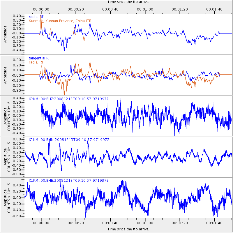
KMI Kunming, Yunnan Province, China - Earthquake Result Viewer
*The percent match for this event was below the threshold and hence no stack was calculated.
| Earthquake location: |
Western Indian-Antarctic Ridge |
| Earthquake latitude/longitude: |
-49.0/123.5 |
| Earthquake time(UTC): |
2008/12/13 (348) 08:59:41 GMT |
| Earthquake Depth: |
10 km |
| Earthquake Magnitude: |
5.5 MB |
| Earthquake Catalog/Contributor: |
WHDF/NEIC |
|
| Network: |
IC New China Digital Seismograph Network |
| Station: |
KMI Kunming, Yunnan Province, China |
| Lat/Lon: |
25.12 N/102.74 E |
| Elevation: |
1975 m |
|
| Distance: |
76.1 deg |
| Az: |
340.665 deg |
| Baz: |
166.084 deg |
| Ray Param: |
$rayparam |
*The percent match for this event was below the threshold and hence was not used in the summary stack. |
|
| Radial Match: |
62.046318 % |
| Radial Bump: |
400 |
| Transverse Match: |
57.692722 % |
| Transverse Bump: |
400 |
| SOD ConfigId: |
2658 |
| Insert Time: |
2010-03-04 22:37:04.987 +0000 |
| GWidth: |
2.5 |
| Max Bumps: |
400 |
| Tol: |
0.001 |
|
Signal To Noise
| Channel | StoN | STA | LTA |
| IC:KMI:00:BHN:20081213T09:10:57.971997Z | 2.9380279 | 3.099271E-7 | 1.0548814E-7 |
| IC:KMI:00:BHE:20081213T09:10:57.971997Z | 1.4171556 | 2.1029246E-7 | 1.4839051E-7 |
| IC:KMI:00:BHZ:20081213T09:10:57.971997Z | 0.8488464 | 9.611981E-8 | 1.13235814E-7 |
| Arrivals |
| Ps | |
| PpPs | |
| PsPs/PpSs | |


