You are here: Home > Network List > PF - Volcanologic Network of Piton de Fournaise-OVPF Stations List
> Station HIM cratere Himiltrude > Earthquake Result Viewer
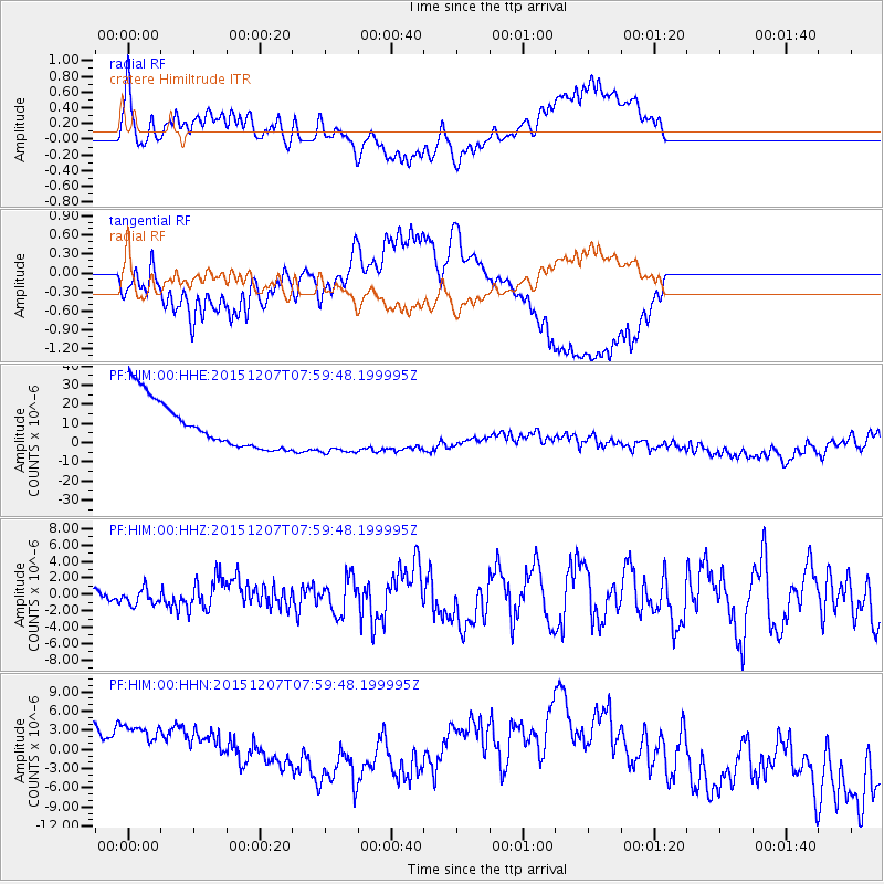
HIM cratere Himiltrude - Earthquake Result Viewer
*The percent match for this event was below the threshold and hence no stack was calculated.
| Earthquake location: |
Tajikistan |
| Earthquake latitude/longitude: |
38.3/72.7 |
| Earthquake time(UTC): |
2015/12/07 (341) 07:50:07 GMT |
| Earthquake Depth: |
29 km |
| Earthquake Magnitude: |
7.2 MWB |
| Earthquake Catalog/Contributor: |
NEIC PDE/NEIC COMCAT |
|
| Network: |
PF Volcanologic Network of Piton de Fournaise-OVPF |
| Station: |
HIM cratere Himiltrude |
| Lat/Lon: |
21.21 S/55.72 E |
| Elevation: |
1958 m |
|
| Distance: |
61.3 deg |
| Az: |
198.122 deg |
| Baz: |
15.213 deg |
| Ray Param: |
$rayparam |
*The percent match for this event was below the threshold and hence was not used in the summary stack. |
|
| Radial Match: |
52.29325 % |
| Radial Bump: |
400 |
| Transverse Match: |
47.99343 % |
| Transverse Bump: |
400 |
| SOD ConfigId: |
7422571 |
| Insert Time: |
2019-04-21 13:35:00.123 +0000 |
| GWidth: |
2.5 |
| Max Bumps: |
400 |
| Tol: |
0.001 |
|
Signal To Noise
| Channel | StoN | STA | LTA |
| PF:HIM:00:HHZ:20151207T07:59:48.199995Z | 1.6041175 | 9.927895E-7 | 6.1890074E-7 |
| PF:HIM:00:HHN:20151207T07:59:48.199995Z | 0.9504836 | 9.858348E-6 | 1.03719285E-5 |
| PF:HIM:00:HHE:20151207T07:59:48.199995Z | 0.97950745 | 1.1271842E-5 | 1.1507663E-5 |
| Arrivals |
| Ps | |
| PpPs | |
| PsPs/PpSs | |


